Shandong Fengtu IOT Technology Co., Ltd
Sales Manager:Ms. Emily Wang
Cel,Whatsapp,Wechat:+86 15898932201
Email:info@fengtutec.com
Add:No. 155 Optoelectronic Industry Accelerator, Gaoxin District, Weifang, Shandong, China

Sales Manager:Ms. Emily Wang
Cel,Whatsapp,Wechat:+86 15898932201
Email:info@fengtutec.com
Add:No. 155 Optoelectronic Industry Accelerator, Gaoxin District, Weifang, Shandong, China
time:2025-07-23 09:05:11 source:Weather Station viewed:534 time
Traditional manual monitoring requires staff to regularly visit various monitoring points and collect data using professional tools. When measuring water levels, devices such as levels may be used, and water level heights are recorded through manual readings. For flow velocity measurement, current meters might be adopted, which require staff to place them in appropriate positions for measurement. This method has many drawbacks and is greatly restricted by weather and geographical conditions. In severe weather such as heavy rains and floods, it is difficult for staff to reach the monitoring points, and forcing a visit would put them at great safety risks. Moreover, the frequency of manual monitoring is limited, making it impossible to achieve real-time and continuous data collection, which is a serious shortcoming for work that requires timely grasp of hydrological changes.
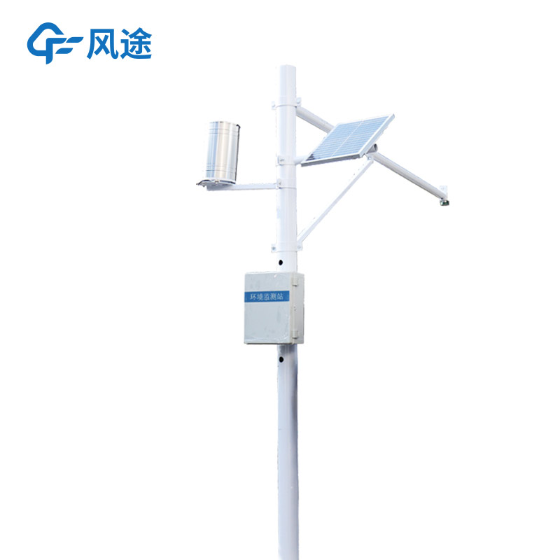
The River Flow Monitoring System is completely different. For flow velocity monitoring, it accurately calculates the water flow speed by emitting radar waves and receiving reflected waves based on the Doppler effect. The flow of water will change the frequency of the reflected waves, and the monitoring station can derive the flow velocity data accordingly. For water level monitoring, radar emits electromagnetic waves to the water surface. The time difference between the emission of electromagnetic waves, their reflection by the water surface, and their reception can be used to accurately calculate the water level height. For rainfall monitoring, radar-type rainfall monitors use tipping bucket rain gauges to measure precipitation. Additionally, by combining flow velocity and water level data and using specific algorithms, the monitoring station can also calculate and output flow data.
In this way, the advantages are obvious: First, it realizes non-contact measurement, which is completely free from interference from factors such as water quality, sediment, and floating objects on the water surface, greatly improving the accuracy and reliability of measurement results. Second, it can perform real-time and continuous monitoring, automatically collecting and transmitting data at regular intervals, allowing relevant departments to keep abreast of the latest hydrological information at any time. Third, it has a high degree of automation. Data collection, storage, and transmission can all be completed automatically, significantly reducing labor input. Staff only need to use terminal devices such as computers or mobile phones to remotely view and manage data without having to visit the site frequently.
In flood control and flood fighting work, the River Flow Monitoring System can monitor changes in water level and flow in real-time. Once the data exceeds the warning value, it will quickly issue an early warning, providing a basis for flood control decisions.

Radar flowmeter is the use of microwave technology for water level and flow rate detection instrument, it will be mature radar water level meter and radar flow meter measurement technology, mainly used for rivers, reservoir gates, underground waterway pipe network, irrigation channels and other null...
Shipborne automatic weather station is a kind of meteorological observation system using ship as a working platform, which is capable of real-time observation of elements of marine meteorology such as temperature, air pressure, humidity, wind speed, wind direction, rainfall and visibility. In the fi...
types of anemometer Such as cup anemometer, propeller anemometer, hot wire anemometer, wind vane anemometer, ultrasonic anemometer, pressure anemometer, tube anemometer....
Fengtu is a manufacturer specializing in the R&D, production, and sales of environmental monitoring instruments. Its Water Quality Monitor is an electrode-based analytical instrument that can deliver test results within 10 seconds, capable of measuring 14 parameters such as water temperature, co...