Shandong Fengtu IOT Technology Co., Ltd
Sales Manager:Ms. Emily Wang
Cel,Whatsapp,Wechat:+86 15898932201
Email:info@fengtutec.com
Add:No. 155 Optoelectronic Industry Accelerator, Gaoxin District, Weifang, Shandong, China


Sales Manager:Ms. Emily Wang
Cel,Whatsapp,Wechat:+86 15898932201
Email:info@fengtutec.com
Add:No. 155 Optoelectronic Industry Accelerator, Gaoxin District, Weifang, Shandong, China
Model:FT-S20
Brand:fengtu
one.Water transparency sensor application environment description
Water transparency sensor calculates the transparency of water by measuring the absorbance of a substance in water to light, and can accurately measure the content of the dissolved substance in the water.Measures transparency in water using the scattering or absorption properties of light. It has high sensitivity, fast response and real-time monitoring capabilities, and is widely used in fields such as water quality monitoring and sewage treatment.
Signal output: RS485 (MODBUS-RTU).
Infrared LED light source, strong anti-interference ability.
Internal signal isolation technology, strong interference resistance.
Good reproducibility, thermal stability, low drift, small size, fast response
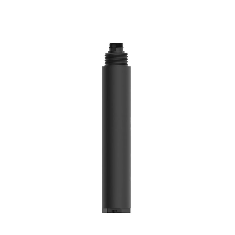
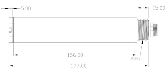
Easy and simple installation, 3/4NPT pipe thread, convenient for submersible installation or installation in pipes and tanks
Stable performance and long service life
IP68 waterproof standard
two. Water transparency sensor technical performance and specifications
1.Technical parameters
| Measurement principle | scattered light method |
| Signal mode | RS485 (MODBUS-RTU) |
| Measuring range | 50~1000mm |
| Measurement resolution | 1mm |
| Measurement accuracy | ±5% (depending on sludge homogeneity) |
| Shell material | Glass and ABS |
| Cable length | Standard 5 meters |
| Supply voltage | 12-24VDC (product power consumption is about 0.4W when powered by 12V) |
| Calibration method | Two point calibration |
| Measurement environment | Temperature 0~50℃ (non-freezing), <0.2MPa |
| Waterproof level | IP68 |
| Installation method | Submersible installation, NPT3/4 thread |
2.Water transparency sensor dimension diagram
three. Water transparency sensor installation and electrical connections
1.Installation
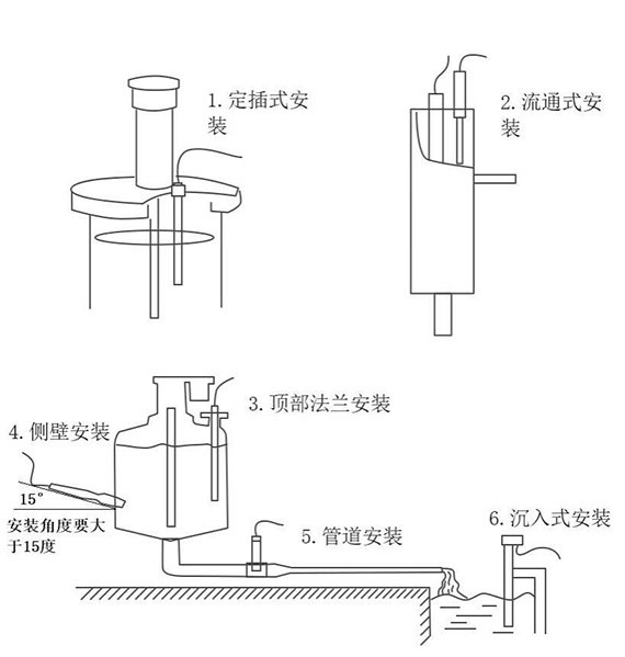
Note: The sensor cannot be installed upside down or horizontally, and must be installed at an angle of at least 15 degrees.
2. Electrical installation
The cable is a 5-core shielded wire, wire sequence definition: brown - power cord (12~24VDC)
Black - Ground (GND)
Blue-485A Green-485B
Yellow-4-20mA current output (can be left floating if not used)
The wiring sequence should be carefully checked before powering on to avoid unnecessary losses caused by wiring errors.
Four. Water transparency sensor maintenance and care
1.Use and maintenance
Conventional electrodes require periodic cleaning and calibration, and the maintenance cycle is determined by the customer based on his or her own working conditions. Conventional electrode cleaning method: use a soft brush to remove attachments (be careful to avoid scratching the electrode surface), then clean with distilled water, and then perform calibration operations.
The Soil Moisture Monitoring Station is an automated device to measure soil moisture and temperature. It consists of a sensor, a data collector, a communication module and a power supply system that automatically collects data and sends it to a remote monitoring centre. This equipment is useful in a...
The rapid development of industrialisation has led to air pollution, which refers to the accumulation in the atmosphere of substances released by human activities or natural processes to a certain extent, causing negative impacts on human beings and the environment.China's air pollution is chang...
what does a rain gauge measure Collect the water that falls on it and record the change in rainfall over time, usually expressed in millimeters, providing a usable rainfall measure....
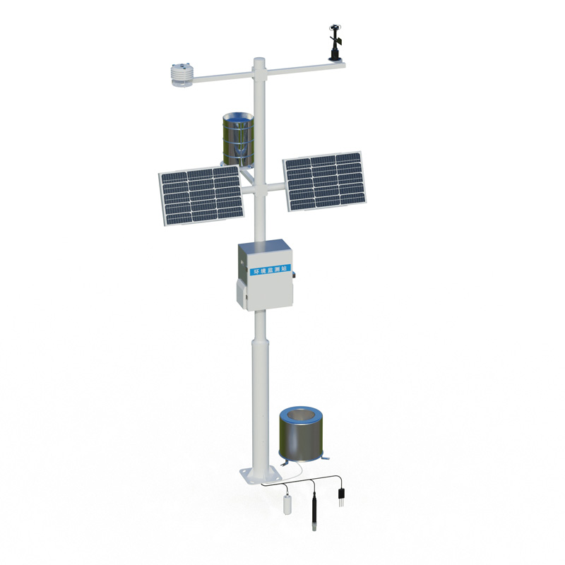
An air quality monitoring station is a device system based on the concept of grid - based layout, which conducts all - round and refined monitoring of air quality in a specific area. It divides the monitoring area into multiple grids and sets up monitoring stations at key positions in each grid to a...


 Get a Free Quote

 Skype
Skype
 whatsapp
 mail
mail