Shandong Fengtu IOT Technology Co., Ltd
Sales Manager:Ms. Emily Wang
Cel,Whatsapp,Wechat:+86 15898932201
Email:info@fengtutec.com
Add:No. 155 Optoelectronic Industry Accelerator, Gaoxin District, Weifang, Shandong, China


Sales Manager:Ms. Emily Wang
Cel,Whatsapp,Wechat:+86 15898932201
Email:info@fengtutec.com
Add:No. 155 Optoelectronic Industry Accelerator, Gaoxin District, Weifang, Shandong, China
Model:FT-HQ1
Brand:fengtu
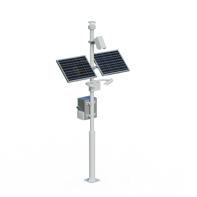
Ship weather station is designed to provide critical marine weather and wind observation data under the rigorous conditions of offshore operations.
Main use locations: on ships, drilling platforms, islands, ports
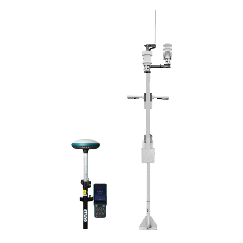
1. Ship weather station product overview
Ship weather station mainly uses comprehensive acquisition control technology, computer software technology, communication technology and other technologies to integrate various meteorological sensors from structure to system composition. It can continuously obtain marine meteorological information, and can perform real-time detection of visibility, ultrasonic wind speed, ultrasonic wind direction, air temperature, air humidity, atmospheric pressure, optical rainfall, light intensity, etc. It can complete the collection of various data through remote transmission and send it to the transportation department in time, providing first-hand information for marine-related departments to provide meteorological support services. On this basis, it can provide timely meteorological information services for marine safety authorities and people's travel.
The meteorological sensors used in the ship weather station include: visibility weather phenomenon detector, wind, humidity, temperature, pressure, rain and light integrated micro-weather station, Beidou high-precision positioning instrument, etc., as well as special comprehensive meteorological data collector, support structure, power supply and communication control box and other units.
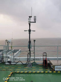
Real photos
2.Ship weather station function
(1) Able to conduct real-time detection of visibility, ultrasonic wind speed, ultrasonic wind direction, air temperature, air humidity, atmospheric pressure, optical rainfall, light intensity, Beidou positioning, etc.
(2) Actively collect data of various meteorological elements, pre-process and process the collected data with algorithms, perform relevant statistics on the collected data to form minute-by-minute values and store them in the memory of the monitoring station;
(3) Automatically upload monitoring data with an upload frequency of 1 minute;
(4) The meteorological monitoring station provides RS232, RS485, RJ45 network port, GPRS wireless and other communication methods;
(5) System power supply mode: 220V AC mains or 12VDC solar power.
3.Ship weather station instrument features
l The monitoring station adopts modular assembly structure design, which is compact and small, and each sensor is small in size, light in weight, and easy to install;
lThe system has low power consumption, less than 10W, and can be powered by either mains electricity or solar energy;
The system has lightning protection measures. Its communication interface and power interface are designed with lightning protection to minimize the damage caused by lightning strikes.
4. Ship weather station main sensors and unit components
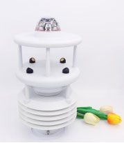
a) Visibility weather phenomenon detector
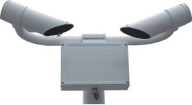
b) Small ultrasonic automatic weather station
c) Beidou positioning detector
5. Typical technical indicators of Ship weather station
Measuring features | Measuring range | Resolution | Accuracy |
visibility Weather phenomena | 5m~10km | 1m | ≤2km, error ±2% 2km—10km, error ±5% Weather phenomenon measurement types: fog (light fog, mist, dense fog), rain (light rain, moderate rain, heavy rain), snow (light snow, moderate snow, heavy snow), mixed precipitation (rain and snow), etc. |
Temperature | -40~+80℃ | 0.1℃ | ±0.2℃ |
Relative humidity | 0~100% | 0.1% | ±2% |
wind direction | 0~360° | 1° | ±3° |
Wind speed | 0~75m/s | 0.01m/s | ±2% |
Precipitation (mm) | 0-10mm/min | 0.01mm | ±0.4mm (accumulated rainfall <10mm); |
Air pressure | 150 ~1200hPa | 0.1hPa | ±1 hPa |
Light intensity | 0-200000LMUX | 0.1LUX | 0.054LUX |
Comprehensive meteorological data collector | Modbus485 interface: GX-12-4P aviation plug, output power supply voltage 12V Equipment configuration interface: GX-12-4P aviation plug, input voltage 5V. Collector power supply interface: GX-12-3P aviation plug, input voltage 5V, with RS232 output. Collector power supply: DC5V ±0.5V peak current 1A. Working environment temperature: -10~+45℃. Working environment: -20-80℃, humidity ≤100% without condensation. Communication mode: support modbus485, support GPRS communication, support RS232 data output, support Lora wireless communication, data upload interval: 30s-65535s adjustable. Working current: 20mA, sleep current: <50uA. Extended sensor protocol: modbus485, maximum number of extended sensors: 32, Extended sensor voltage: 12V Extended sensor current: ≤2A Built-in sensors: temperature, humidity, atmospheric pressure | ||
Overall power supply mode | 220V AC mains or 12VDC "solar + battery" power supply | ||
Overall power consumption | Each sensor in the system is designed with low power consumption, and the power consumption is less than 10W | ||
Marine meteorological monitoring instruments, also known as ship weather instruments, are specifically designed for the marine environment. They integrate six parameters—temperature, humidity, wind speed, wind direction, air pressure, and rainfall—into a single unit, enabling 24-hour continu...
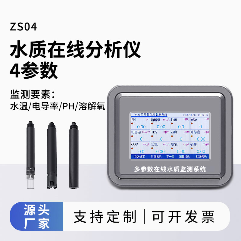
The pH value of water is extremely crucial in both ecology and human activities. In ecological terms, it directly affects the survival and reproduction of aquatic organisms. A suitable pH environment is the basis for aquatic organisms to carry out normal physiological activities. Unsuitable pH will...
A marine meteorological visibility meter is an instrument specifically designed to monitor visibility in the ocean. In general, a marine meteorological visibility meter measures the real-time visibility of the atmosphere and provides real-time monitoring, early warning and forecasting functions. Thr...
An air quality monitoring station is a technical system used for real - time monitoring of pollutant concentrations in the atmosphere. It can monitor air quality in real - time and give early warnings of pollution incidents. This system typically consists of sensors, data acquisition devices, data t...


 Get a Free Quote
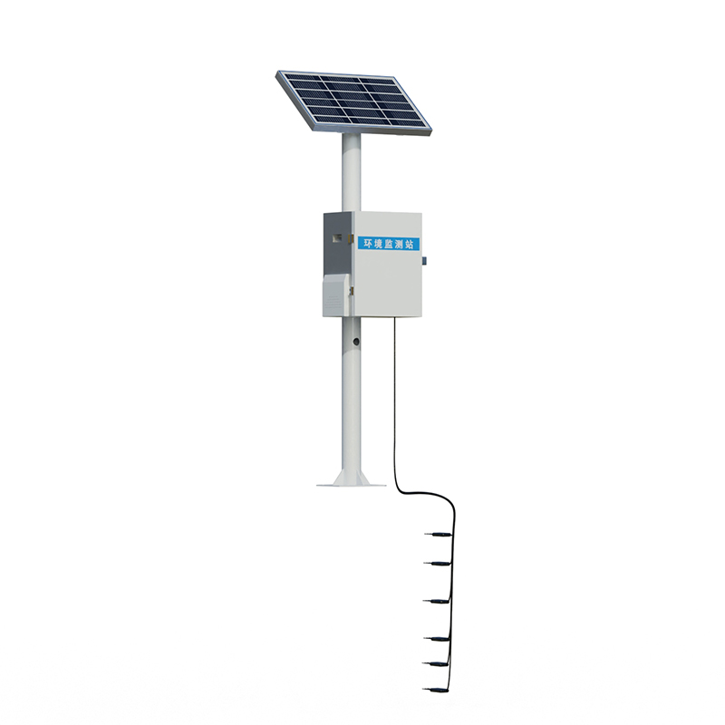
 Skype
Skype
 whatsapp
 mail
mail