Shandong Fengtu IOT Technology Co., Ltd
Sales Manager:Ms. Emily Wang
Cel,Whatsapp,Wechat:+86 15898932201
Email:info@fengtutec.com
Add:No. 155 Optoelectronic Industry Accelerator, Gaoxin District, Weifang, Shandong, China


Sales Manager:Ms. Emily Wang
Cel,Whatsapp,Wechat:+86 15898932201
Email:info@fengtutec.com
Add:No. 155 Optoelectronic Industry Accelerator, Gaoxin District, Weifang, Shandong, China
time:2024-12-18 09:36:22 source:Weather Station viewed:775 time
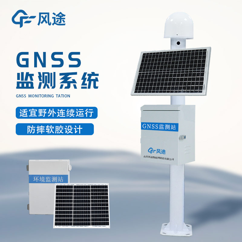
The GNSS Monitoring Station can detect potential dangers in a timely manner by monitoring mountain displacements with high precision. It can collect the three-dimensional coordinates of monitoring points on the mountain surface in real time, with an accuracy reaching the centimeter or even millimeter level. These monitoring points are distributed at key parts such as the slope surface and the edge of cracks, and continuously send position information at a set frequency. The displacement change of the collected coordinates is analyzed to calculate the displacement amount and rate. Once it exceeds the preset threshold, an alarm will be issued. For example, for a mountain monitoring point beside a highway in a certain mountainous area, if the horizontal displacement exceeds 10 centimeters within a short time and the rate accelerates, it indicates the risk of landslide.
The GNSS Monitoring Station is integrated with other monitoring means to comprehensively judge the stability of the mountain. When combined with the meteorological monitoring system, during heavy rainfall weather (such as the rainfall exceeding 50 millimeters per hour), if there is an obvious change in the mountain displacement at the same time, the system will raise the alarm level, because rainfall will increase the weight of the mountain and reduce the shear strength of the soil. At the same time, when used in conjunction with the internal monitoring equipment of the geotechnical body, the internal sensors measure parameters such as pore water pressure and earth pressure. When the pore water pressure rises and there is displacement at the monitoring points on the mountain surface, it more accurately indicates the danger of landslide.
This system has an alarm and emergency response mechanism. There are multiple levels of alarm thresholds. A yellow alarm is issued when the displacement amount is 5 - 10 centimeters, and a red alarm is issued when it exceeds 10 centimeters and the rate is fast. Once the alarm is triggered, it can automatically link to the emergency response, notify departments such as geological disaster prevention and traffic management and nearby residents, and also provide detailed displacement data to assist in the formulation of emergency rescue plans, effectively preventing the harm of mountain landslides.
Micrometeorology is a subtle change in climate caused by factors such as small-scale topography, such as localised wind, fog and frost. In certain sections of transmission lines, these micrometeorological phenomena may be exacerbated by topographical influences, for example, leading to conductor ice...
In coal mining, which is a crucial part of the industry, ensuring operational safety, enhancing productivity and maintaining environmental health are the primary goals. Our micro-weather monitoring equipment provides real-time and accurate weather data monitoring and forecasting services for mining...
Archives, as places where important artefacts, materials and books are kept, cannot be overstated. A key factor in the deterioration of materials is a change in the temperature and humidity of the environment, which promotes the growth and reproduction of moulds. Therefore, in order to be able to pr...
I. PrefaceAs the “oxygen provider” of modern cities, the subway not only drives the urban economic development but also leads the transformation of the way people live. However, in recent years, subway accidents have occurred frequently, and the number of casualties has been on the rise, reflectin...


 Skype
Skype
 whatsapp
 mail
mail