Shandong Fengtu IOT Technology Co., Ltd
Sales Manager:Ms. Emily Wang
Cel,Whatsapp,Wechat:+86 15898932201
Email:info@fengtutec.com
Add:No. 155 Optoelectronic Industry Accelerator, Gaoxin District, Weifang, Shandong, China


Sales Manager:Ms. Emily Wang
Cel,Whatsapp,Wechat:+86 15898932201
Email:info@fengtutec.com
Add:No. 155 Optoelectronic Industry Accelerator, Gaoxin District, Weifang, Shandong, China
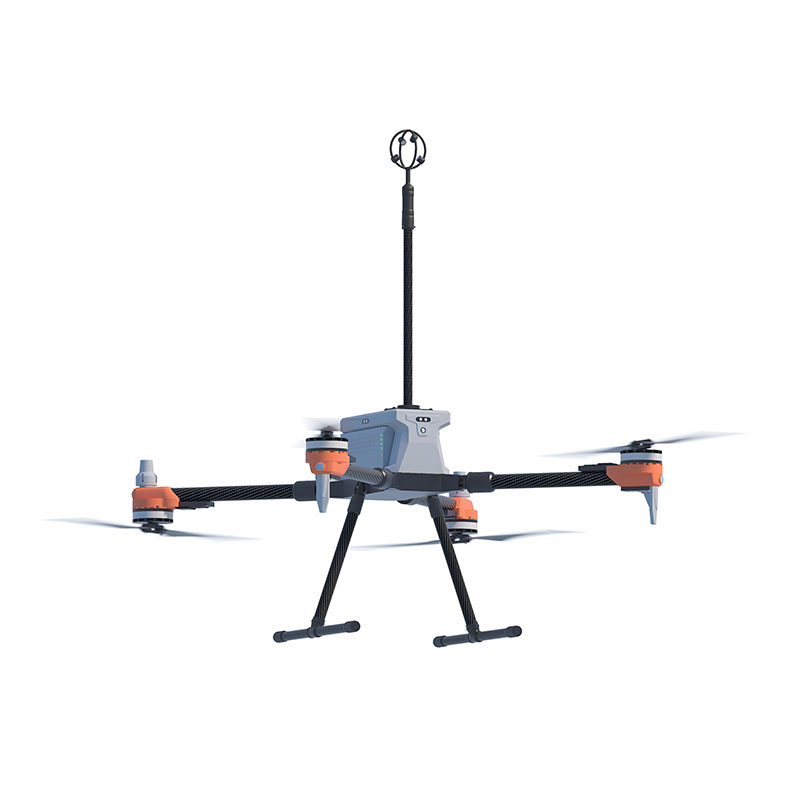
Model:FT-F1H
Brand:fengtu
1、3D Anemometer for Unmanned Aerial Vehicles Product Introduction
3D Anemometer for Unmanned Aerial Vehicles is an instrument that measures wind speed and direction using the principle of measuring the time difference of ultrasonic waves propagating through the air.3D Anemometer for Unmanned Aerial Vehicles features a compact design (measuring path of only 35 mm) and a lightweight construction (114 grams). Despite its small size, it is a powerful and highly accurate wind measurement sensor used for atmospheric monitoring, weather reporting, and environmental airflow system research, providing data on wind speed, wind direction, inclination, electronic compass, and BeiDou navigation system.
3D Anemometer for Unmanned Aerial Vehicles provides precise three-dimensional wind measurement data of airflow. Data output can be customized according to user requirements.
The small size and lightweight design of the 3D Anemometer for Unmanned Aerial Vehicles make it a perfect choice for Unmanned Aircraft Systems (UAS). The absence of moving parts eliminates maintenance issues, allowing it to be placed on fixed or mobile platforms for real-time three-dimensional airflow measurements in natural environments.
2、3D Anemometer for Unmanned Aerial Vehicles Application Areas
Atmospheric detection and scientific research
U, V, W vector output
UAV-based high-altitude airflow monitoring system
Emergency rescue and special surface air turbulence monitoring
Monitoring of upward airflow on slopes for weather modification
3、3D Anemometer for Unmanned Aerial Vehicles Technical Parameters
| Wind speed | Measurement range | 0-50m/s |
| Precision | ±2% | |
| Resolution | 0.1m/s | |
| Wind direction | Measurement range (U/V) | 0-359° |
| Measurement range (W) | ±60° | |
| Precision | ±3° | |
| Resolution | 1° | |
| Ultrasonic output frequency | 1Hz (standard output); 2Hz, 5Hz, 10Hz (optional) | |
| Unit of measurement | m/s,knots,mph,kph,ft/min | |
| Digital/analog output interface | RS232/RS485 (one of them) | |
| Communication baud rate | 4800-19200 | |
| Protection level | IP65 | |
| Working temperature | -40℃-+70℃ | |
| Electromagnetic shielding | Meet EN61000-6-2 standard | |
| Power requirements and consumption | DC9-30V (30mA@12V) | |
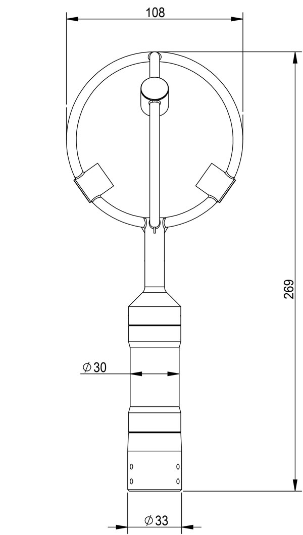
| Dimensions/weight | Φ108×269mm/114g | |
| Materials | Black resin | |
4、3D Anemometer for Unmanned Aerial Vehicles Product dimensions diagram
Soil moisture refers to the content of water in the soil, which is crucial for plant growth. The humidity of the soil can be measured by several key indicators:Soil saturation water contentThis refers to the maximum water content that the soil can achieve, where all the pores in the soil are fille...
In the protracted battle of preventing and controlling air pollution, accurately monitoring pollution sources and grasping the dynamic change trends of pollution are important prerequisites for implementing effective governance. The Air Quality Micro-station launched by Fengtu is a key instrument in...
what instrument measures wind direction used to measure wind direction is called an anemometer and records wind speed, direction, and gust strength....
sensors for farming is a powerful tool to collect accurate information of crops, fields and equipment, mainly including light sensors, carbon dioxide sensors, air temperature and humidity sensors, etc....


 Get a Free Quote
 Skype
Skype
 whatsapp
 mail
mail