Shandong Fengtu IOT Technology Co., Ltd
Sales Manager:Ms. Emily Wang
Cel,Whatsapp,Wechat:+86 15898932201
Email:info@fengtutec.com
Add:No. 155 Optoelectronic Industry Accelerator, Gaoxin District, Weifang, Shandong, China


Sales Manager:Ms. Emily Wang
Cel,Whatsapp,Wechat:+86 15898932201
Email:info@fengtutec.com
Add:No. 155 Optoelectronic Industry Accelerator, Gaoxin District, Weifang, Shandong, China
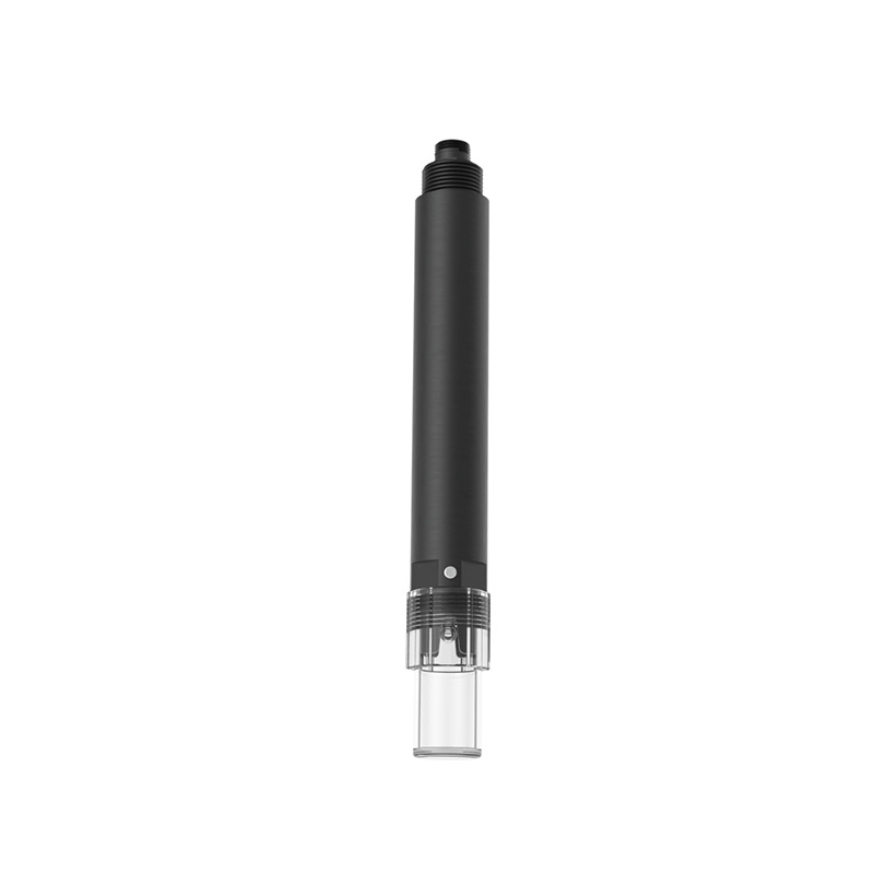
Model:FT-WJN4
Brand:fengtu
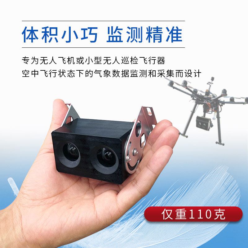
1.UAV visibility detector product features
UAV visibility detector is a professional optical instrument that converts the measured atmospheric extinction coefficient into meteorological visibility through backscattering.
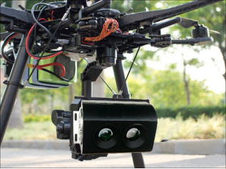
1.The UAV visibility detector weighs only 110 grams and is designed for meteorological data monitoring and collection in the air flight of unmanned aircraft or small unmanned patrol vehicles;
2.It has a compact appearance, strong anti-electromagnetic interference and dustproof function, and can work normally in an altitude of 4,000 meters and minus 20 degrees;
3.The "four-ultra" visibility meter with ultra-mini appearance, ultra-low wind resistance, ultra-light weight and ultra-low power consumption has a power consumption of only 0.9 watts, making it very suitable for small drone platforms and flight control systems, as well as environmental monitoring using aircraft;
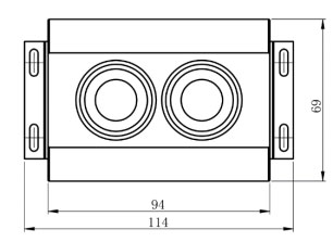
2.UAV visibility detector size and weight
Visibility dimensions: 94mm*69mm*42mm
Visibility + mounting bracket size: 114mm*69mm*73mm
Visibility weight: 110g
3.Main technical parameters of UAV visibility detector
Test range: 10-4000 meters
Measurement accuracy: ±15%
Light source: IR LED
Response time: 10 seconds
Digital output: RS485, RS232, SDI-12
Bluetooth output: BLE5.0 (optional)
Working temperature: -20-50°C
Working humidity: 0-95%
Supply voltage: VDC 12-24V
Power consumption: 0.9W
4.UAV visibility detector product size diagram and real image
The construction of the Internet of Things meteorological monitoring system needs to be based on modern information technology. The new model based on the combination of Internet of Things technology with computer technology and communication network technology is a meteorological observation method...
The rainfall monitoring station is small in size, easy to install and maintain, and inexpensive. It is very suitable for mountain flood early warning, hydrological forecasting and other work. It realizes real-time collection, remote transmission and online monitoring of rainfall data through hardwar...
Rainfall is a common weather phenomenon. Sometimes there is little rainfall and there is drought, and sometimes there is a lot of rainfall and there is flooding and waterlogging. Precipitation is unstable, so people need to grasp the amount of rainfall, so that they can develop various countermeasur...
Weather forecasts provide timely information on the weather in the coming days. In the case of typhoon and rainstorm forecasts, precautions need to be taken in advance, and as modern agriculture continues to develop, the agro-meteorological environment is increasingly being taken into account. Espec...


 Get a Free Quote
 Skype
Skype
 whatsapp
 mail
mail