Shandong Fengtu IOT Technology Co., Ltd
Sales Manager:Ms. Emily Wang
Cel,Whatsapp,Wechat:+86 15898932201
Email:info@fengtutec.com
Add:No. 155 Optoelectronic Industry Accelerator, Gaoxin District, Weifang, Shandong, China


Sales Manager:Ms. Emily Wang
Cel,Whatsapp,Wechat:+86 15898932201
Email:info@fengtutec.com
Add:No. 155 Optoelectronic Industry Accelerator, Gaoxin District, Weifang, Shandong, China
time:2022-11-21 08:45:21 source:Weather Station viewed:925 time
Automatic radar water level rainfall monitoring system has the advantages of simple structure and low cost, which is widely used in water conservancy projects. At present, the number of automatic radar water level rainfall stations is increasing and the degree of automation is improving, and there has been a great development in its function and technology.
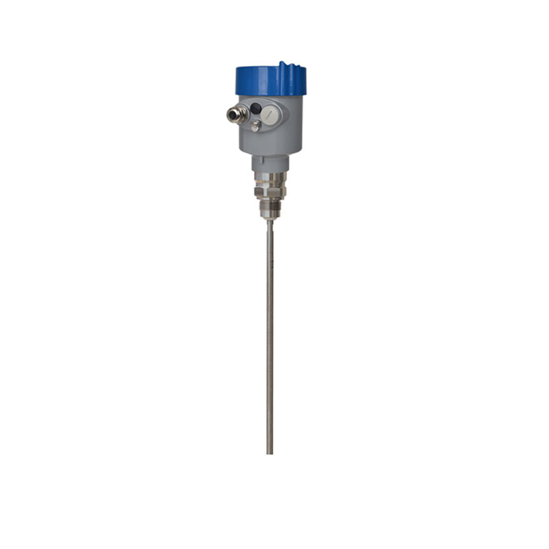
Windway Technology is a manufacturer of automatic radar water level rainfall monitoring system, which adopts microwave radar technology and combines the experience accumulated over the years to develop a series of products to realize the real-time detection of various water conditions. Since this product can complete the collection and display of water level, flow rate and flow velocity information without manual operation and guarding compared with traditional manual rainfall measurement, it is generally welcomed in the domestic market. This is an advanced and reliable, easy to use and easy to manage intelligent water monitoring equipment for the majority of water conservancy workers to provide a good solution.
Hydrological information is one of the most important components of water resources, including river water quantity, water quality and hydrometeorological data, and hydrological monitoring equipment can be based on these data for unified analysis, the results in the form of text or charts to show, so that users can understand the situation and make appropriate decisions in a timely manner, in order to achieve timely warning and control the reservoir release or water transfer purposes.
Automatic radar water level and rainfall monitoring system is to use intelligent sensors to obtain water flow change parameters, wind direction and speed, water level condition, rainfall intensity and other index information, through computer processing to form a complete comprehensive information chart of water conditions. It can also send flood forecast information and other kinds of disaster warning tips to users. In the actual application process, the automatic radar water level rainfall monitoring system is generally composed of monitoring station, communication platform and so on. Among them, the monitoring station is the core part of the whole system operation, which not only undertakes the task of collecting, storing and organizing the massive hydrological basic data signal resources, but also responsible for receiving, storing and transmitting the data transmission requests from various parties. In addition, between each monitoring point, a wireless communication network network has to be established, so as to ensure smooth communication.

The pH value of water is a critical indicator for measuring the acidity and alkalinity of water bodies, ranging from 0 to 14. A pH of 7 is neutral, below 7 is acidic, and above 7 is alkaline. In natural water bodies, pH affects the survival and reproduction of aquatic organisms. For example, fish ty...
Automatic water quality monitoring is of great significance for freshwater resource management. Its monitoring parameters include physical parameters (such as temperature, pH value, turbidity) and chemical parameters (such as dissolved oxygen, residual chlorine). Temperature reflects the hydrotherma...
During all stages from the production to the usage of photovoltaic modules, various defects in solar cells may occur, such as broken grid lines, leakage, black heart wafers, missing corners, cracked wafers, poor soldering, short circuits, etc. These defects are difficult to detect with the naked eye...
Windway introduces the 10-in-1 Micro Weather Meter, a solution to the challenges of environmental monitoring. This device is capable of comprehensively monitoring key environmental indicators such as temperature, humidity, barometric pressure, wind speed, wind direction, illuminance, rainfall, noise...


 Skype
Skype
 whatsapp
 mail
mail