Shandong Fengtu IOT Technology Co., Ltd
Sales Manager:Ms. Emily Wang
Cel,Whatsapp,Wechat:+86 15898932201
Email:info@fengtutec.com
Add:No. 155 Optoelectronic Industry Accelerator, Gaoxin District, Weifang, Shandong, China


Sales Manager:Ms. Emily Wang
Cel,Whatsapp,Wechat:+86 15898932201
Email:info@fengtutec.com
Add:No. 155 Optoelectronic Industry Accelerator, Gaoxin District, Weifang, Shandong, China
time:2026-11-04 09:27:16 source:Weather Station viewed:4 time
Integrated, self-powered GNSS monitoring stations utilize differential RTK (Real-Time Kinematic) technology to provide millimeter-level displacement data for engineering safety monitoring. These units consolidate a GNSS receiver, a power supply system, and a communication module into a single enclosure. They offer a horizontal static accuracy of ±2.5 mm + 1 ppm and a vertical accuracy of ±5 mm + 1 ppm. The system supports signal tracking for the BeiDou-3 satellite constellation and incorporates a choke-ring antenna along with magnetic wave-absorbing materials to suppress multipath effects. Designed to operate in temperatures ranging from -40°C to 85°C, the units are well-suited for long-term, continuous operation in complex field environments.
The core value of these integrated, self-powered GNSS monitoring stations lies in their combination of high-precision positioning capabilities and autonomous power supply within a single housing. Equipped with a high-capacity lithium battery and support for solar charging, the devices can operate for over 90 days without sunlight. Combined with low-power processing units and adaptive frequency-scaling strategies, this significantly reduces the frequency of maintenance required at remote monitoring sites. For communication, the stations support 4G cellular networks and local LoRa networking, with differential data compatible with the RTCM3 format. Displacement calculations can be performed locally on the device or transmitted back to a central platform for processing, offering flexibility for engineering sites with varying network conditions.
In practical engineering applications, these integrated GNSS monitoring stations are primarily deployed on structures such as dam bodies, bridge piers, and the surfaces of potential landslide zones. In the case of a reservoir dam, for example, the stations are deployed in pairs—consisting of a reference station and a measurement station—with a baseline distance kept within 500 meters to ensure the effectiveness of differential corrections. The measurement station transmits the calculated 3D coordinate changes via a wireless link to a monitoring center, where the platform generates displacement-over-time curves and triggers threshold-based alarms. Models such as the Huace Navigation (CHCNAV) H7 have been deployed in landslide early-warning projects—notably in Wulong, Chongqing—where they successfully detected accelerating surface deformation during periods of sustained heavy rainfall, providing critical data to support decisions regarding personnel evacuation. In terms of device specifications, the unit weighs less than 3 kg, allowing for on-site installation and commissioning by a single person. With an IP68 ingress protection rating, it is fully resistant to heavy rain and dust.
For bridge health monitoring, the integrated design offers the advantages of flexible placement and reduced cabling costs. Traditional modular monitoring stations require separate mounting of antennas, enclosures, and solar panels on bridge decks and piers—a setup where cables running across structural gaps are prone to wear from vibration. In contrast, this integrated device houses all components within a cylindrical enclosure (360 mm in diameter and 163 mm in height) and is ready for operation once secured to the target monitoring point. The device supports the Modbus-RTU protocol and RS485 interface expansion, enabling the connection of external environmental sensors—such as inclinometers or rain gauges. By correlating displacement data with orientation and meteorological parameters, the system helps operations and maintenance personnel distinguish between actual structural deformation and periodic fluctuations caused by temperature effects.
From the perspective of system integration, the product supports direct data transmission via TCP, HTTP, and UDP. Displacement readings and alarm statuses can be pushed directly to a user’s existing platform, eliminating the need to rely on a proprietary cloud service. For water resource or transport management agencies that already operate safety monitoring systems, this means new GNSS monitoring points can be incorporated into a unified interface with minimal data integration costs, preventing the creation of "information silos." The device’s onboard offline processing capability ensures that data is stored locally and alarm conditions are evaluated even during communication outages; once the connection is restored, the device automatically transmits the stored historical data, ensuring the continuity of monitoring records. Overall, this integrated, self-powered GNSS monitoring station strikes an optimal balance—tailored to the realities of engineering sites—between precision, power consumption, and ease of deployment, providing a scalable technical solution for long-term deformation tracking of slopes, dams, and bridges.
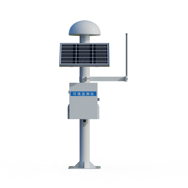
A visibility detector is a device used to measure atmospheric visibility. It helps meteorologists, traffic controllers, pilots, and others to understand the current visibility conditions in the atmosphere so that they can make decisions accordingly.In meteorology, visibility is a key concept that de...
Is it necessary to monitor the flow rate in farmland irrigation and drainage?Farmland irrigation and drainage, simply put, is a set of methods for managing water in farmland, including both irrigation and drainage.First, let's talk about irrigation. Crops need water to grow. Irrigation is about...
GNSS receiver price This product, which utilizes differential RTK technology to achieve millimeter-level displacement monitoring, is priced at 6900 RMB. It boasts high accuracy and strong stability, making it suitable for safety monitoring of engineering projects such as dams, bridges, and lan...
rainfall detection is a device designed to detect the presence and intensity of rainfall, which can detect changes in rainfall in real time, regardless of sunlight, dust, leaves, etc....


 Skype
 whatsapp
 mail