Shandong Fengtu IOT Technology Co., Ltd
Sales Manager:Ms. Emily Wang
Cel,Whatsapp,Wechat:+86 15898932201
Email:info@fengtutec.com
Add:No. 155 Optoelectronic Industry Accelerator, Gaoxin District, Weifang, Shandong, China


Sales Manager:Ms. Emily Wang
Cel,Whatsapp,Wechat:+86 15898932201
Email:info@fengtutec.com
Add:No. 155 Optoelectronic Industry Accelerator, Gaoxin District, Weifang, Shandong, China
time:2025-06-18 09:19:07 source:Weather Station viewed:599 time
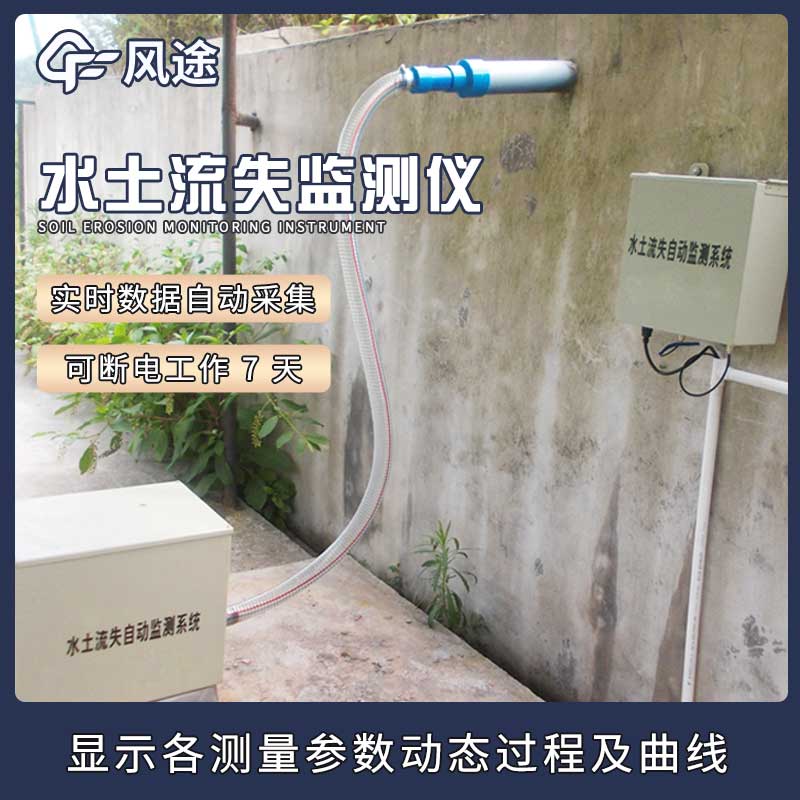
Soil erosion refers to the process in which soil minerals, organic matter, and substances dissolved in water are dispersed, transported, and deposited under the action of water, wind, gravity, and human factors. Its hazards are multifaceted. On the one hand, it leads to a decline in soil fertility, reduces the area of cultivated land, and decreases crop yields, affecting agricultural production. On the other hand, a large amount of sediment flowing into rivers, lakes, and reservoirs will silt up river channels, reduce reservoir capacity, and increase the frequency and severity of flood disasters, posing a threat to water resource utilization and the operation of water conservancy projects. Additionally, it will aggravate soil erosion, deteriorate the ecological environment, reduce land productivity, and affect ecological balance and sustainable development.
To effectively monitor the status of soil erosion, the FT-LS1 Soil Erosion Monitoring system is introduced by meteorological station manufacturers. It adopts an integrated structure and integrates high-precision sensors such as a rain gauge, sediment sensor, and flow sensor, which can real-time monitor multiple key parameters including rainfall, rainfall intensity, runoff, and sediment content.
The advantages of the FT-LS1 Soil Erosion Monitoring system are as follows:
It can work unattended around the clock, automatically measure and store key data. The data acquisition and storage main control unit can manage, store, and remotely transmit data, ensuring it enters a dormant state when there is no rainfall or runoff, and can operate for 7 days even in case of power outages.
It is powered by solar energy, which is energy-saving and environmentally friendly, and reduces operating costs.
The sediment concentration measurement sensor can real-time monitor the sediment concentration in runoff, the surface flow sensor assembly can automatically measure surface flow, and the rainfall sensor is dedicated to measuring rainfall-related data. The data processing is flexible, supporting local storage, interface download, and wireless transmission. Users can use computer software to online real-time monitor and display the dynamic process and curves of each measurement parameter, download historical data, etc. They can also freely set the sampling frequency and calibrate the clock on the data management main control unit on-site. The system is equipped with central control computer software, which can draw charts of runoff, sediment content, rainfall, number of rainfall events, runoff, infiltration, soil erosion, etc., based on the collected data, facilitating users to intuitively understand the situation of soil erosion.
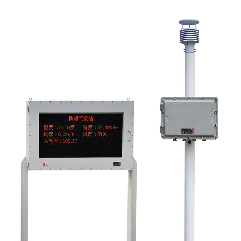
Explosion-proof automatic weather station, mainly used for environmental monitoring and management in electric power, petroleum, chemical and other industries, is a meteorological observation instrument. It can monitor the changes of various meteorological data in the atmosphere exactly within a cer...
Water and Rain Monitoring SystemWater and rain conditions are important hydrological reference materials and are of great significance in regional water resources allocation and management. It refers to the water and rain conditions, and the specific index parameters are water level, flow rate, flow...
The 5-in-1 Weather Sensor is a compact monitoring device integrating multiple meteorological parameter measurement functions, capable of simultaneously acquiring five core meteorological data: wind speed, wind direction, temperature, humidity, and atmospheric pressure. Through a highly integrated de...
Atmospheric environment monitoring sensors, as an important tool for monitoring physical and chemical parameters in the atmospheric environment, function by collecting real-time data on temperature, humidity, barometric pressure, wind speed, wind direction, and air quality. These sensors have a wide...


 Skype
Skype
 whatsapp
 mail
mail