Shandong Fengtu IOT Technology Co., Ltd
Sales Manager:Ms. Emily Wang
Cel,Whatsapp,Wechat:+86 15898932201
Email:info@fengtutec.com
Add:No. 155 Optoelectronic Industry Accelerator, Gaoxin District, Weifang, Shandong, China


Sales Manager:Ms. Emily Wang
Cel,Whatsapp,Wechat:+86 15898932201
Email:info@fengtutec.com
Add:No. 155 Optoelectronic Industry Accelerator, Gaoxin District, Weifang, Shandong, China
time:2025-11-19 10:02:17 source:Weather Station viewed:408 time
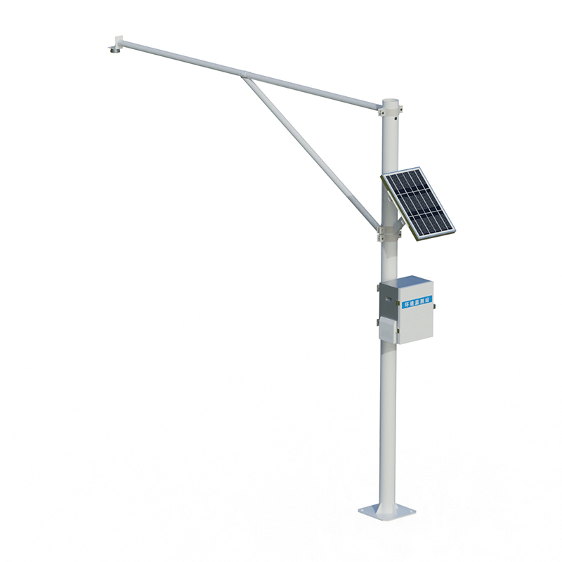
Water Level Monitoring Station is a technological facility that uses low-power intelligent sensing devices as its core to continuously monitor the water levels of rivers and lakes. This system provides decision support for flood control, disaster reduction, and water resource management by accurately collecting hydrological data.
Water Level Monitoring Station adopts an integrated design, featuring low power consumption, small size, and high reliability. Its monitoring process is unaffected by factors such as temperature changes, sediment content, water pollutants, and floating debris, ensuring the continuity and accuracy of data acquisition. This design allows the equipment to operate stably in complex field environments, while reducing the frequency and difficulty of subsequent maintenance.
As an intelligent monitoring solution for the water conservancy industry, this system is mainly applied in three areas: In flood control and disaster reduction, it provides crucial data for flood season early warning and emergency dispatch by monitoring water level changes in real time; in water resource management, the continuously accumulated hydrological data provides a basis for water use planning and rational allocation; and in ecological environmental protection, long-term monitoring data helps assess the ecological status of the watershed and supports the implementation of water ecological restoration projects. Furthermore, these detailed and reliable monitoring records also serve as an important foundation for hydrological scientific research and long-term water resource planning.
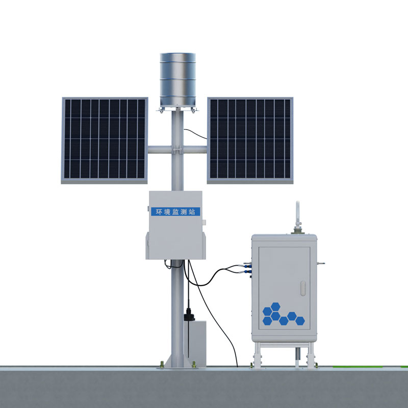
This system is a high-tech integrated system combining sensing, transmission, and processing modules. Its core components include water level sensors, data acquisition units, communication equipment, and a power supply unit. The water level sensors are responsible for accurately capturing changes in water surface elevation; the data acquisition units perform preliminary processing and storage of the monitoring data; the communication equipment enables remote data transmission; and the power supply unit provides stable power support for the entire system. These components work together to ensure the continuous operation of the monitoring work.
In practical applications, Water Level Monitoring Station primarily monitors the water levels of various water bodies such as rivers, lakes, and reservoirs in real time. This continuous observation capability makes it play an irreplaceable role in flood control and drought relief efforts. When the water level reaches the warning threshold, the system issues timely warnings, buying valuable time for personnel evacuation and engineering scheduling. During droughts, the system's monitoring data becomes an important reference for the unified allocation of water resources.
With continuous technological advancements, Water Level Monitoring Station is developing towards greater intelligence and networking. The new generation of monitoring stations not only improves the accuracy of single-point monitoring but also achieves comprehensive coverage at the watershed scale through network operation. This systematic monitoring network provides solid technical support for building a modern water governance system and demonstrates increasingly important value in water security and sustainable water resource utilization.
Boat Depth Finder automatically calculates water depth data by transmitting and receiving acoustic signals via an ultrasonic transducer. The device simultaneously displays water temperature, latitude and longitude coordinates, travel speed, time and date, and Bluetooth connection status....
As the scale of the power grid continues to expand, the number and length of transmission lines are also growing rapidly, posing increasing challenges to traditional transmission line inspection methods. Traditional inspection methods not only involve a huge workload but also have many shortcomings,...
This meter employs a K-band planar microstrip array antenna, integrating vertical angle compensation and flow velocity averaging functions. It achieves a velocity measurement range of 0.1-20 m/s with an accuracy of ±0.01 m/s, and a water level measurement range of 0-30 meters. It is suitable...
As an important means of flood and drought disaster early warning, the automatic monitoring system of water and rain is of great significance to the realization of water resources security. Like the automatic weather station, it has the functions of data collection, analysis, processing and early wa...


 Skype
Skype
 whatsapp
 mail
mail