Shandong Fengtu IOT Technology Co., Ltd
Sales Manager:Ms. Emily Wang
Cel,Whatsapp,Wechat:+86 15898932201
Email:info@fengtutec.com
Add:No. 155 Optoelectronic Industry Accelerator, Gaoxin District, Weifang, Shandong, China


Sales Manager:Ms. Emily Wang
Cel,Whatsapp,Wechat:+86 15898932201
Email:info@fengtutec.com
Add:No. 155 Optoelectronic Industry Accelerator, Gaoxin District, Weifang, Shandong, China
time:2022-12-05 17:11:35 source:Weather Station viewed:1315 time
Radar water level meter is a non-contact precision water level measuring instrument. The application of this instrument makes the hydrological test transition from the traditional full-time manual observation mode to the modern hydrological digital mode, which improves the efficiency.
The radar water level meter is suitable for rivers where it is inconvenient or impossible to install floats or pressure water level meters, and also for mountainous rivers. It has the advantages of strong water level tracking ability, simple maintenance, relatively low post maintenance cost, accurate measurement, high resolution and fast transmission rate.
The application of radar water level meter provides a basis for establishing a new mode of water level monitoring and management mainly based on patrol and supplemented by grid-based patrol area, and creates favorable conditions for hydrological stations to realize the operation and management mode of "manned and unmanned" as soon as possible. Since the comparison year is a normal year, the water level does not change much, so the adaptability of the radar water level meter to the conditions cannot be fully tested. When the sudden change of river potential at the cross section caused by super standard flood and water level rise, more data should be collected to further verify the performance index of the radar water level meter, and to verify and improve it.
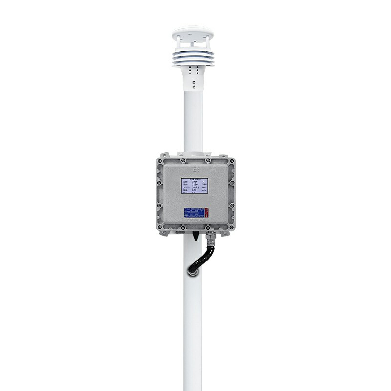
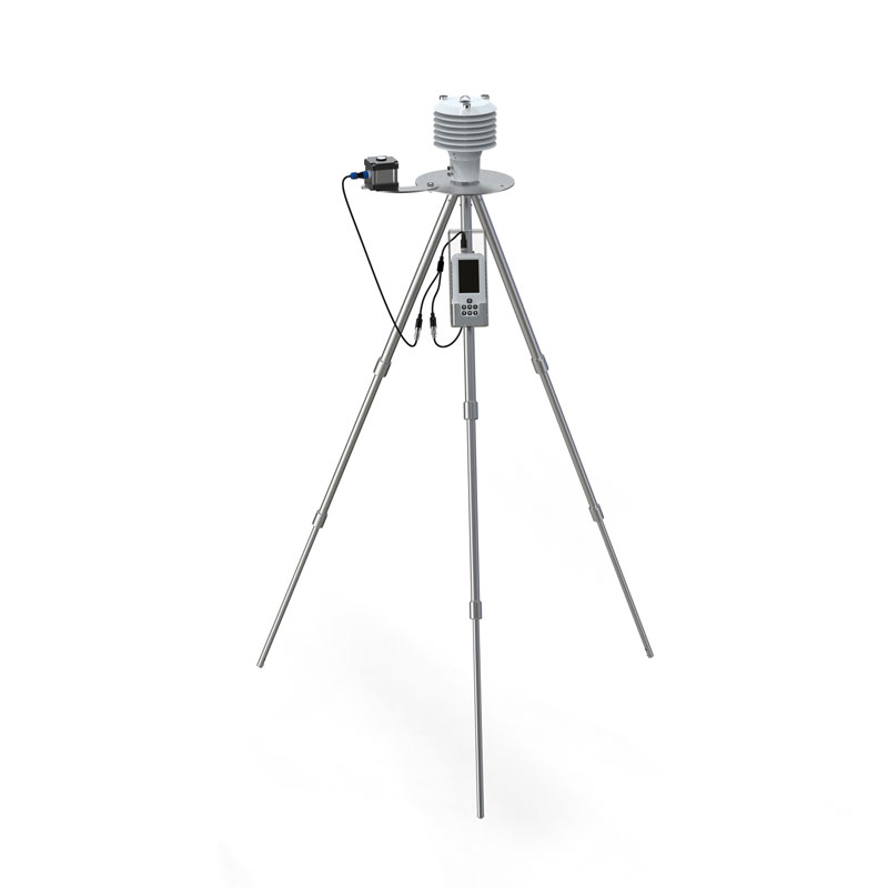
The five element weather monitor is used to monitor the five elements of weather, namely temperature, humidity, air pressure, wind speed and wind direction. It usually consists of a number of sensors and data loggers that can monitor and record these elements in real time. The five element weather m...
Rainwater online monitoring system can effectively monitor the rainfall situation in real time, and also has data storage and analysis functions, which plays a very important role in rainfall warning and flood prediction. Windway Technology is a manufacturer of rainwater online monitoring system, pr...
Villa weather station monitoring equipment is a kind of monitoring instrument used to monitor temperature and humidity, wind speed and direction, air pressure, PM2.5, PM10 and other weather environment parameters of the villa. Its structure includes: sensor module, communication transmission module,...
ultrasonic weather station can provide accurate and reliable weather data, measuring wind speed, wind direction, temperature, humidity, barometric pressure, optical rainfall, etc....


 Skype
Skype
 whatsapp
 mail
mail