Shandong Fengtu IOT Technology Co., Ltd
Sales Manager:Ms. Emily Wang
Cel,Whatsapp,Wechat:+86 15898932201
Email:info@fengtutec.com
Add:No. 155 Optoelectronic Industry Accelerator, Gaoxin District, Weifang, Shandong, China


Sales Manager:Ms. Emily Wang
Cel,Whatsapp,Wechat:+86 15898932201
Email:info@fengtutec.com
Add:No. 155 Optoelectronic Industry Accelerator, Gaoxin District, Weifang, Shandong, China
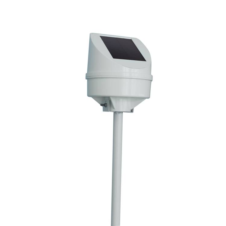
Model:FT-DH2
Brand:fengtu
1.Geological disaster monitoring system product overview
Geological disaster monitoring system realizes 24-hour intelligent monitoring, millimeter-level monitoring accuracy and second-level real-time warning.The geological disaster monitoring system has the advantages of small size, high precision, easy installation, and complete functions.It can conduct all-weather real-time safety monitoring of the object being measured, and has multiple advantages such as intelligence, cloud mode, and high precision.It can monitor the attitude tilt of the device in the three directions of X, Y, and Z in real time, measure the relative displacement and azimuth of the monitoring point, and thus judge the surface conditions.By monitoring the tilt of the object being measured in real time, when the monitoring alarm exceeds the alarm value, an alarm is issued for the tilt state of the object being measured, and the information is uploaded to the cloud platform.
2.Technical parameters of geological disaster monitoring system
1.Measurement parameters
Acceleration: Measurement range: ±0.7g, Measurement accuracy: ±0.1%, Resolution: 0.06mg, Overload tolerance: 300g
Inclination: Measuring range: 0~39°, Measuring accuracy: ±0.1°, Resolution: 0.001°, Measuring direction: X, Y, Z
Displacement: Measuring range: ±500mm, Measuring accuracy: ±0.12mm, Resolution: 0.03mm
2.Other parameters
Signal transmission: 4G wireless data transmission
Power supply: Solar energy + lithium battery combination power supply
Working temperature: -40~85℃
Working humidity: 0~95%RH (non-condensing)
Solar panel: 3W
Lithium battery: 5200mAh
Reporting interval: 1 minute to 24 hours, configurable, supports secret reporting
3.Features of Geological disaster monitoring system
1.Integration: IoT communication terminals, data storage and processing units, high-performance batteries, solar panels and sensors are integrated into one host.
2.Careful circuit design, fast response time, various output methods, test data, and analyze trends
3.High precision, strong stability, effective analysis, automatic warning, simple and comfortable structure design, making maintenance easier;
4.Wireless data transmission, no need to set up communication lines, long transmission distance, high transmission efficiency, can ensure the integrity, security and immediacy of data;
5.The power supply method of solar energy + lithium battery combination can not only avoid the waste of resources and space occupation of setting up power supply lines, but also ensure that there will be no power outages in the case of continuous rainy days for more than ten days.
6.The manufacturing enterprise has ISO quality management system, environmental management system and occupational health management system certification
7.The manufacturer has a computer software registration certificate
8.The manufacturer is a 3A credit enterprise
4.Application fields of geological disaster monitoring system
It is widely used to observe geological conditions such as mountain slopes, seaside embankments, tunnels, highway embankments and bridges.
5.Geological disaster monitoring system cloud platform
1.CS architecture software platform, supports direct observation through mobile phones and PC browsers, without the need to install additional software.
2.Support multiple accounts and multiple devices to log in
3.Support real-time data display and historical data display dashboard
4.Cloud servers and cloud data storage are stable, reliable, easy to expand, and load balanced.
5.Support SMS alarm and threshold setting
6.Support map display and view device information.
7.Support data curve analysis
8.Support data export in table format
9.Support data forwarding, HJ-212 protocol, TCP forwarding, http protocol, etc.
10.Support data post-processing function
11.Support external running of javascript scripts
noise sensor is an electronic device that can measure sound levels or noise signals, monitor ambient noise levels and send data to a platform or controller for remote monitoring....
Ultrasonic Wind Speed Direction Sensor accurately captures wind direction changes, providing crucial data support for meteorology, agriculture, energy, and engineering construction....
rients such as nitrogen, phosphorus and potassium. This comprehensive monitoring capability greatly enhances the prevention of and response to agro-meteorological disasters, provides strong data support for meteorological services for modern agriculture, and lays a solid foundation for promoting the...
In the wave of globalization and industrialization, the ecological environment of water bodies such as rivers and lakes faces great challenges. To protect and restore these precious natural resources, it is necessary to use the Water Quality Monitor System to monitor and analyze the water body condi...


 Get a Free Quote
 Skype
Skype
 whatsapp
 mail
mail