Shandong Fengtu IOT Technology Co., Ltd
Sales Manager:Ms. Emily Wang
Cel,Whatsapp,Wechat:+86 15898932201
Email:info@fengtutec.com
Add:No. 155 Optoelectronic Industry Accelerator, Gaoxin District, Weifang, Shandong, China


Sales Manager:Ms. Emily Wang
Cel,Whatsapp,Wechat:+86 15898932201
Email:info@fengtutec.com
Add:No. 155 Optoelectronic Industry Accelerator, Gaoxin District, Weifang, Shandong, China
time:2024-12-06 09:32:12 source:Weather Station viewed:721 time
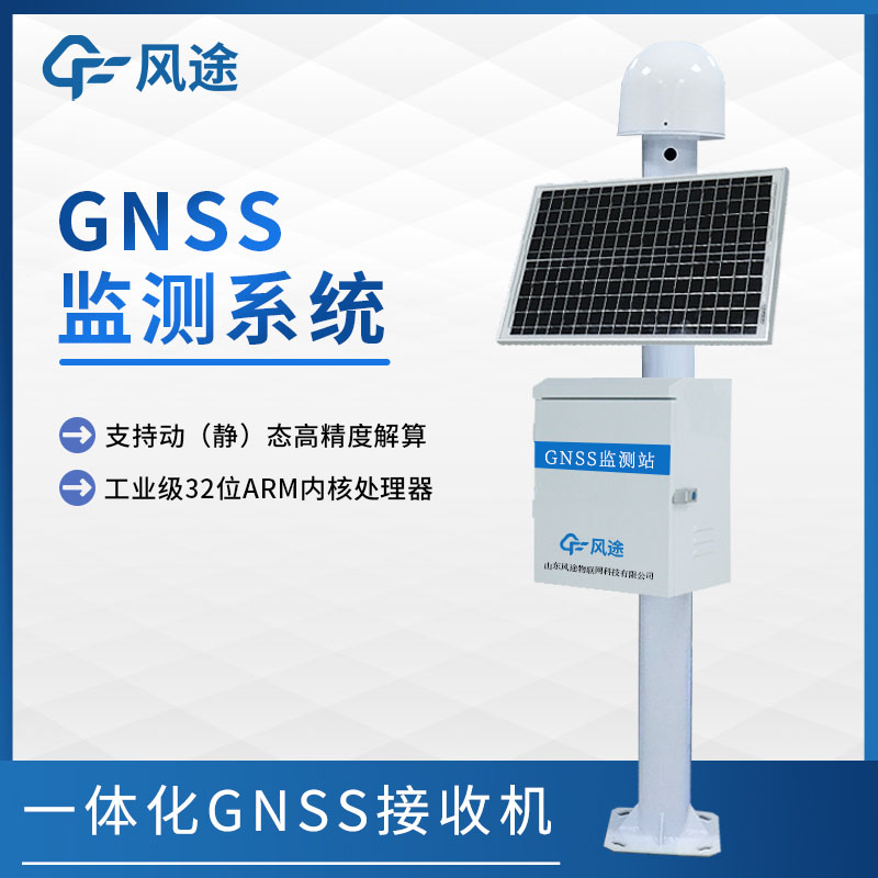
The GNSS (Global Navigation Satellite System) monitor is a displacement measuring device based on the global navigation satellite system. When in operation, the antenna of the monitor fully receives satellite signals, which contain crucial information such as satellite orientation and time. The receiver quickly amplifies, filters, and demodulates the signals to remove interference and extract the effective content. Then, the data processing unit uses professional algorithms to accurately calculate the three-dimensional coordinates of the location. The power supply provides stable power throughout the process to ensure the smooth operation of the equipment.
In the field of geodesy, when drawing maps and conducting engineering surveys, it can quickly lock the coordinates of control points with its high-precision advantage, strengthening the foundation of the preliminary work. In terms of geological disaster monitoring, by setting up monitoring points in areas prone to landslides and subsidence, it continuously tracks the slightest ground displacements. Once any abnormality occurs, it will immediately send out warnings, seizing the initiative for emergency rescue and disaster relief. In transportation, it provides precise navigation for vehicles and ships, plans the optimal routes, reduces the risk of accidents, and improves traffic efficiency. Its existence is not only a demonstration of scientific and technological achievements but also a powerful driving force for promoting the steady development of multiple industries.
What happens when weather sensors are plugged into the Sea Ranch?What is a sea ranch?Within a selected sea area, through the establishment of comprehensive fishery facilities and management processes (e.g., large-scale marine organism hatchery bases, massive installation of artificial reefs, introdu...
In winter, frequent icy and snowy weather brings challenges to road traffic safety due to issues such as snow, ice, and water accumulation on roads. To ensure smooth road networks and reduce accident risks, the current mainstream monitoring solution is to use Non - Contact Road Condition Sensors on...
3D Ultrasonic Anemometer utilizes the ultrasonic phase difference principle to measure wind speed and direction. Using multiple pairs of ultrasonic probes, it simultaneously measures the wind speed components along the mutually perpendicular X, Y, and Z axes in three-dimensional space (i.e., t...
In the construction project of automated geological disaster monitoring, the rainfall monitoring station, as an important device, plays a crucial role in the prevention and response to geological disasters.Heavy rainfall is a key factor triggering geological disasters such as debris flows and landsl...


 Skype
Skype
 whatsapp
 mail
mail