Shandong Fengtu IOT Technology Co., Ltd
Sales Manager:Ms. Emily Wang
Cel,Whatsapp,Wechat:+86 15898932201
Email:info@fengtutec.com
Add:No. 155 Optoelectronic Industry Accelerator, Gaoxin District, Weifang, Shandong, China


Sales Manager:Ms. Emily Wang
Cel,Whatsapp,Wechat:+86 15898932201
Email:info@fengtutec.com
Add:No. 155 Optoelectronic Industry Accelerator, Gaoxin District, Weifang, Shandong, China
time:2025-06-04 09:22:29 source:Weather Station viewed:818 time
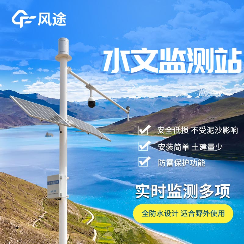
In the fields of water conservancy management and flood control and disaster reduction, water level monitoring is of great importance, and the Water Level Monitoring System achieves efficient and accurate monitoring of water levels.
The Water Level Monitoring System is mainly composed of front-end monitoring equipment, a data transmission network, and a back-end data processing platform. The front-end equipment includes water level sensors that use technologies such as radar to monitor water level changes in real time, converting water level data into electrical or digital signals. The data transmission network utilizes communication technologies such as 4G to quickly and stably transmit the data collected by the front-end to the back-end platform. After receiving the data, the back-end data processing platform stores, analyzes, and displays it, allowing staff to intuitively view dynamic water level change curves, historical data, and other information.
This system features automation, real-time performance, and high precision. It can operate 24 hours a day, 7 days a week, eliminating the need for frequent manual on-site measurements, which greatly improves monitoring efficiency and reduces labor costs. The monitoring data is updated every minute or even every second, ensuring that staff can grasp water level changes in real time. At the same time, high-precision sensors and algorithms keep water level monitoring errors within a minimal range, providing a reliable basis for decision-making.
The Water Level Monitoring System also has an early warning function. When the monitored water level reaches or exceeds a preset threshold, the system immediately issues alarms through various means such as text messages and APP notifications to remind relevant personnel to take countermeasures, effectively preventing the occurrence of flood disasters. In water resources management, water conservancy project scheduling, and other tasks, the accurate water level data provided by this system also provides a strong support for scientific decision-making.
Automatic radar water level rainfall monitoring system has the advantages of simple structure and low cost, which is widely used in water conservancy projects. At present, the number of automatic radar water level rainfall stations is increasing and the degree of automation is improving, and there h...
Radar level meter is a kind of liquid level measurement device using radar technology, which has the following main features:Non-contact measurement: no need to touch the liquid, suitable for dirty or corrosive liquids.Wide measurement range: suitable for liquid level heights from a few centimetres...
A wind sensor is a sensor device used to measure and record the direction of the wind, usually in the fields of meteorology, environmental monitoring and agriculture. It calculates the wind direction by measuring the wind speed and, based on the principles of hydrodynamics. These sensors usually pro...
From ancient times to the present, agriculture has always been based on agriculture. "Food is the most important thing for the people" shows the importance of agriculture. The damage caused by meteorological disasters that we have been suffering from is also very serious. In order to ensur...


 Skype
Skype
 whatsapp
 mail
mail