Shandong Fengtu IOT Technology Co., Ltd
Sales Manager:Ms. Emily Wang
Cel,Whatsapp,Wechat:+86 15898932201
Email:info@fengtutec.com
Add:No. 155 Optoelectronic Industry Accelerator, Gaoxin District, Weifang, Shandong, China


Sales Manager:Ms. Emily Wang
Cel,Whatsapp,Wechat:+86 15898932201
Email:info@fengtutec.com
Add:No. 155 Optoelectronic Industry Accelerator, Gaoxin District, Weifang, Shandong, China
time:2025-12-19 09:14:21 source:Weather Station viewed:503 time
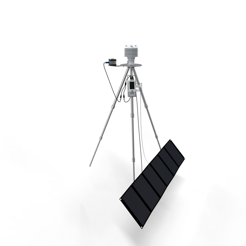
The electronic weather instrument is a portable device that integrates multiple meteorological data, including wind speed, wind direction, temperature, humidity, atmospheric pressure, altitude, thermal index, wet-bulb temperature, wave height, dew point temperature, wind chill index, and GNSS positioning. This highly integrated instrument is widely used in environmental monitoring, meteorological research, third-party testing, and emergency response, providing accurate meteorological data support.
The electronic weather instrument is an integrated portable detection device whose core function is to monitor and record multiple meteorological parameters in the atmosphere in real time. Key parameters it can measure include wind speed, wind direction, and average wind speed. These data directly reflect airflow conditions and play a fundamental role in outdoor operations, environmental assessment, and meteorological research. Simultaneously, the instrument accurately measures temperature and humidity, two important indicators for analyzing environmental comfort and weather changes. Atmospheric pressure and altitude data are acquired through built-in sensors and can be used to assess air pressure change trends and estimate location altitude.
The electronic weather instrument also calculates various composite indices to provide a more comprehensive environmental perception. The thermal index, combining temperature and humidity, reflects the degree of heat perceived by the human body; wet-bulb temperature is used to assess evaporative cooling potential. Dew point temperature indicates the state of air saturation and is key to predicting condensation or fog formation. The wind chill index, combining temperature and wind speed, describes the actual feeling of cold under windy conditions. For near-water or marine environments, some models can estimate wave height parameters, providing a reference for related activities. Furthermore, the device integrates a GNSS tri-mode positioning module, enabling real-time recording of precise latitude, longitude, and altitude information of measurement points, ensuring strict data-geographical binding.
The widespread application of this device is based on its comprehensive parameters and portability. In the field of environmental monitoring, the instrument is used for long-term or short-term air quality and meteorological background value surveys, providing raw data for environmental assessment reports. In meteorological monitoring, it can supplement fixed stations for localized, refined data collection or temporary observation of meteorological phenomena. Third-party environmental testing agencies commonly use it for on-site inspections and compliance monitoring to ensure that the data collection process meets regulatory requirements. In scientific research, including geography, ecology, and atmospheric science, researchers use this device to acquire firsthand meteorological data in the field, supporting model validation and scientific research.
Emergency response is one of the key application scenarios for electronic meteorological instruments. During natural disasters such as typhoons, rainstorms, or forest fires, emergency personnel can use this device for rapid deployment in disaster areas, monitoring changes in key meteorological elements such as wind speed, wind direction, and air pressure in real time, providing real-time data support for command and decision-making. Its portability and rapid start-up capabilities meet the stringent timeliness requirements of emergency response. The device's robust design typically withstands harsh environments, ensuring reliable operation under complex conditions.
The technical characteristics of electronic meteorological instruments are reflected in their high integration and data accuracy. It integrates multiple sensors into a compact body, using a microprocessor for data acquisition and processing. Users can directly read results on the screen or export records wirelessly. The data logging function allows the device to operate automatically for extended periods, storing time-series meteorological parameters for subsequent analysis and report generation. The user interface is designed for practicality, ensuring users can complete various measurement tasks after simple training.
Overall, electronic weather instruments, by integrating functions such as measuring wind speed, wind direction, temperature, humidity, atmospheric pressure, altitude, multiple composite indices, and GNSS positioning, have become multifunctional portable tools. Their design serves various professional fields including environmental monitoring, meteorological observation, third-party testing, scientific research, and emergency response. Their core value lies in providing real-time, accurate meteorological parameter data with geographic information, assisting users in on-site analysis, decision-making, and long-term research. With advancements in sensor technology, future devices are likely to continue to improve in measurement accuracy, parameter range, and data transmission capabilities.

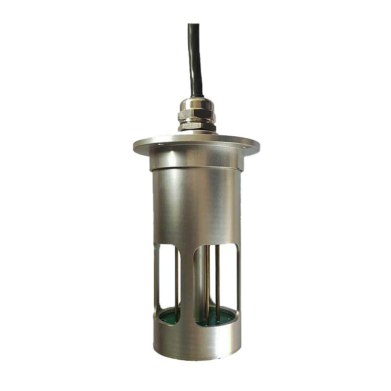
The Fixed Ultrasonic Flow Meter is an instrument that measures flow based on the characteristics of ultrasonic propagation in fluids. Its working principle is rooted in the fact that when ultrasonic waves travel through a fluid, the propagation time in the downstream and upstream directions varies w...
The season of frequent rainfall is accompanied by a corresponding increase in the risk of urban and rural flooding, flash floods, geological disasters and river flooding. During the rainy season, it is critical to accurately monitor rainfall, safeguard infrastructure, rationally plan agricultural ir...
rainfall sensor is a device used to detect rainfall. It integrates optical algorithms to sense rapidly changing weather and accurately detect rainfall in real time....
sensors on roads collect road traffic information, monitor road conditions, weather conditions, ice, snow and water on the road surface, and improve road safety....


 Skype
Skype
 whatsapp
 mail
mail