Shandong Fengtu IOT Technology Co., Ltd
Sales Manager:Ms. Emily Wang
Cel,Whatsapp,Wechat:+86 15898932201
Email:info@fengtutec.com
Add:No. 155 Optoelectronic Industry Accelerator, Gaoxin District, Weifang, Shandong, China


Sales Manager:Ms. Emily Wang
Cel,Whatsapp,Wechat:+86 15898932201
Email:info@fengtutec.com
Add:No. 155 Optoelectronic Industry Accelerator, Gaoxin District, Weifang, Shandong, China
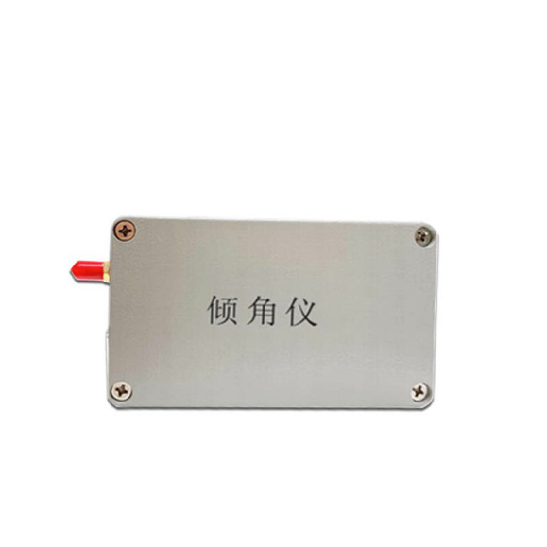
Model:FT-QJ2
Brand:fengtu
1.Dual Axis Inclinometer Product Introduction
Dual Axis Inclinometer is an inclinometer that measures the tilt Angle of an object simultaneously in both horizontal and vertical directions.Our high-precision Dual Axis Inclinometer is mainly used for inclination monitoring of building structures, dangerous buildings, bridges, towers, wind turbines, etc.
2. Dual Axis Inclinometer Technical Parameters
| Range | ±90° (dual axis) |
| Accuracy | Accuracy: ±0.001/±0.005/±0.01 optional |
| Operating voltage | 3.7V~4.2V |
| Rated power consumption | <120 mA/3.7V |
| Operating temperature | -40℃~85℃ |
| Operating humidity | 95%RH without condensation |
| Communication Network | 2~4GPRS/NB -IOT/LORA |
| Collection interval | 1~50Hz high frequency or 0~7200s low frequency can be set as needed |
| Upload strategy | Scheduled upload + event-triggered upload |
| Interactive Control | support |
An anemometer is a tool used to measure wind speed and direction. There are several ways to measure wind, but there are three main types. It is crucial to pick the right anemometer for your needs.A three-cup anemometer is an instrument that consists of two parts: a wind vane and an anemometer. This...
Water level automatic monitoring system is recommended FT-SW1, which is a device for automatic monitoring of river water level data launched by the manufacturer Windway Technology for the market, with a high degree of automation and independent operation in the field, without the need to send someon...
How to obtain rainfall data accurately? Maybe the rainfall monitoring station (FT-YJ1) is a correct choice. It can obtain more rainfall data in detail, including rainfall intensity, rainfall, rainfall time, etc. Rainfall data shall be accurate to year, month, week and day. On the basis of these, mor...
Oil Level Sensor provides real-time online monitoring of oil tank level changes and lubricating oil health status. Made of stainless steel, it offers a range of 300 to 2000 mm with an accuracy of ±0.5% F.S., suitable for various media environments including automobiles, ships, industrial equi...


 Get a Free Quote
 Skype
Skype
 whatsapp
 mail
mail