Shandong Fengtu IOT Technology Co., Ltd
Sales Manager:Ms. Emily Wang
Cel,Whatsapp,Wechat:+86 15898932201
Email:info@fengtutec.com
Add:No. 155 Optoelectronic Industry Accelerator, Gaoxin District, Weifang, Shandong, China


Sales Manager:Ms. Emily Wang
Cel,Whatsapp,Wechat:+86 15898932201
Email:info@fengtutec.com
Add:No. 155 Optoelectronic Industry Accelerator, Gaoxin District, Weifang, Shandong, China
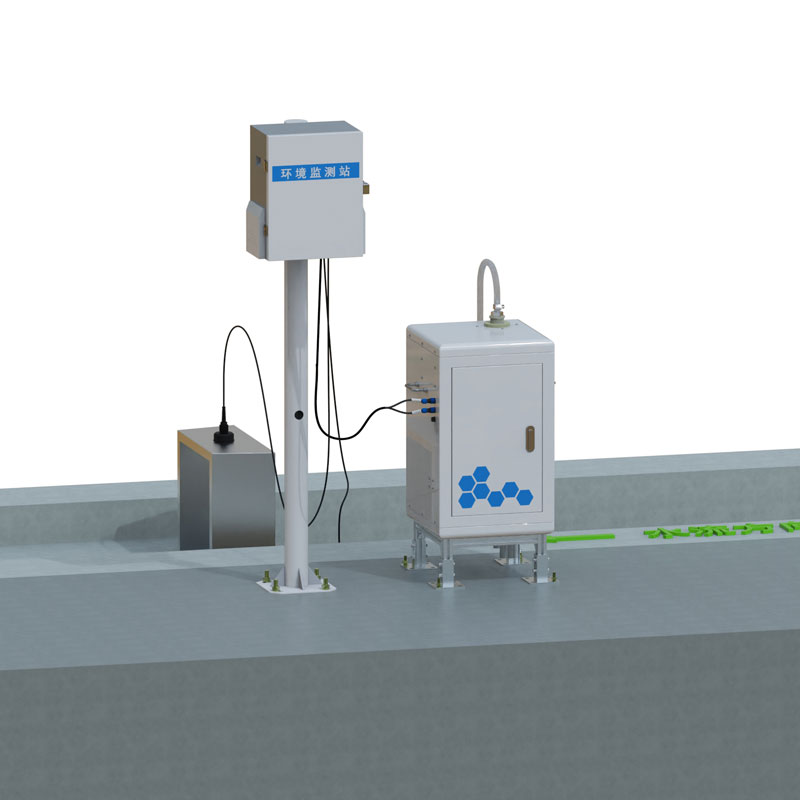
Model:FT-KKY1
Brand:fengtu
1.Fully Automated Soil Erosion Monitoring System Product Introduction
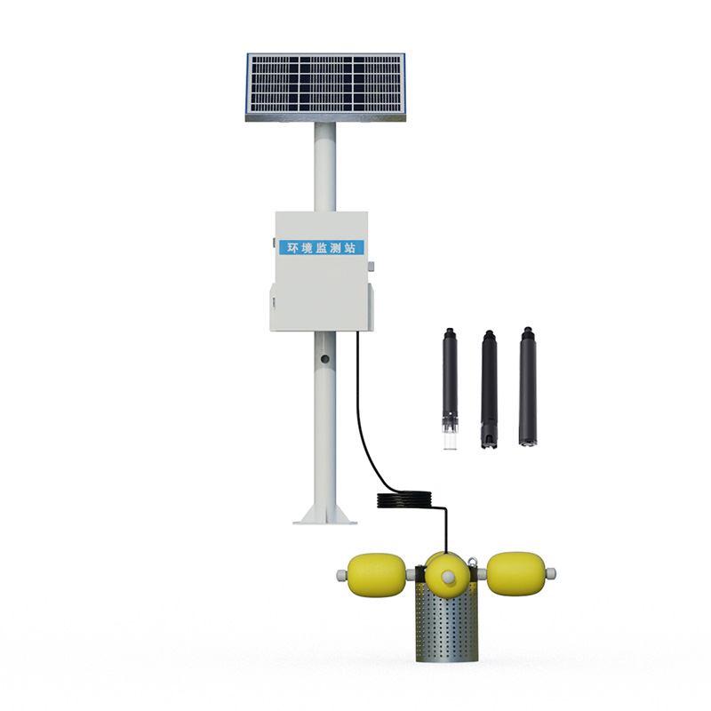
Fully Automated Soil Erosion Monitoring System consists of a data acquisition host computer, a sediment content measurement sensor, an open channel flow sensor, and a rainfall sensor.In the monitoring of soil erosion in runoff fields and small watersheds, traditional manual measurement of flow and sediment and other data has huge workload and low efficiency, and at the same time, high labor costs and large data errors.The automatic soil erosion monitoring system has undergone years of technical research and a large number of field tests and verifications, and has successfully achieved innovation in the traditional manual monitoring model.
This system consists of a data acquisition master, sand content measurement sensor, open channel flow sensor and rainfall sensor.Among them, the open channel flow sensor assembly can automatically measure runoff flow, and accurately calculate the total runoff and instantaneous runoff data for different time periods through the controller; the sand content measurement sensor collects runoff sand content data in real time at the sediment measurement port where the runoff is vertically distributed; the rainfall sensor is responsible for accurately obtaining cumulative rainfall data.The collected data are of key value for soil erosion analysis when each sensor works together.
The system uploads the sediment content, runoff and cumulative rainfall data collected by each sensor to the cloud platform in real time, so that users can retrieve, analyze and manage data anytime and anywhere, and provides scientific and accurate data support for soil and water conservation decisions.
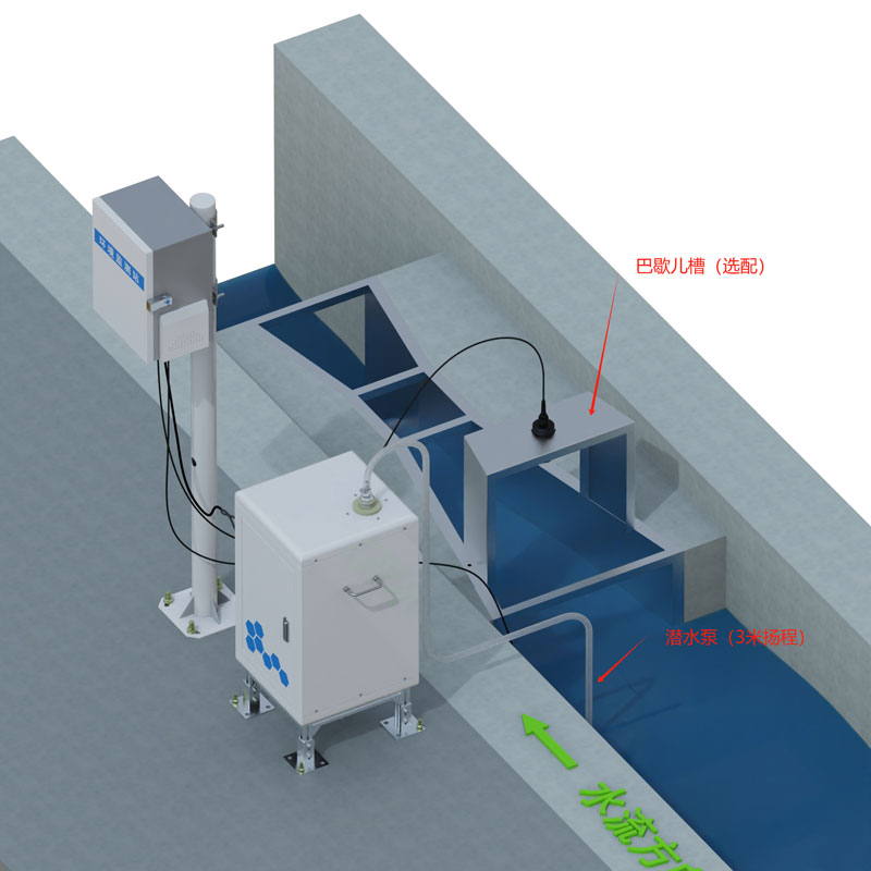
Workflow of sediment content sensor: The surface water body enters the open channel or Bachelor trough from the water drain tank and obtains instantaneous runoff data through the open channel flowmeter, and calculates the total runoff in unit time.The water separator collects the surface water body and is sent to the main water tank.When the surface water capacity to be measured by the main water tank is sufficient for detection, the system starts up and sends the surface water to be measured into the sample chamber for detection.The sensor sends the collected data to the processor and obtains the sediment content after processing.After obtaining the data, the sensor discharges the internal sample from the drain pipe for preparation for the next sampling.The processor is output to an external device via 485.
2.Fully Automated Soil Erosion Monitoring System Product Features
1.Unattended all-weather, automatic measurement: runoff, runoff sand content, total runoff.
2.Powered by municipal power, unattended all-weather and automatically measured data.
3.The pump starts and stops regularly, and is long-lasting and durable.
4.It has the function of real-time online monitoring and displaying dynamic processes and curves and historical data downloads on computer software.
5.The sampling frequency and adjustment clock can be set freely on the data management master.
6.Good stability, high accuracy, strong stability and strong anti-environmental interference capability for sensors.
3.Fully Automated Soil Erosion Monitoring System Technical Parameters
| Runoff flow measurement | |
| Resolution | 0.1m³/h |
| Measurement accuracy | 1% to 5% of the range (depending on the accuracy of the weir tank) |
| Blind area | 30~50cm |
| Sand content measurement | |
| Measurement principle | Weighing method |
| Sampling frequency | 1~99 minutes |
| Measurement range | 0~500kg/m3; |
| Resolution | 0.01kg/m3 |
| Measurement accuracy | <10% |
| General indicators | |
| Water pump flow | 750GPH |
| Communication method | RS485 |
| Working power supply | DC12V |
| Working environment | Temperature: 0 (no freezing) ~ 50℃; humidity: <95% (no condensation) |
| Working life | >1 year |
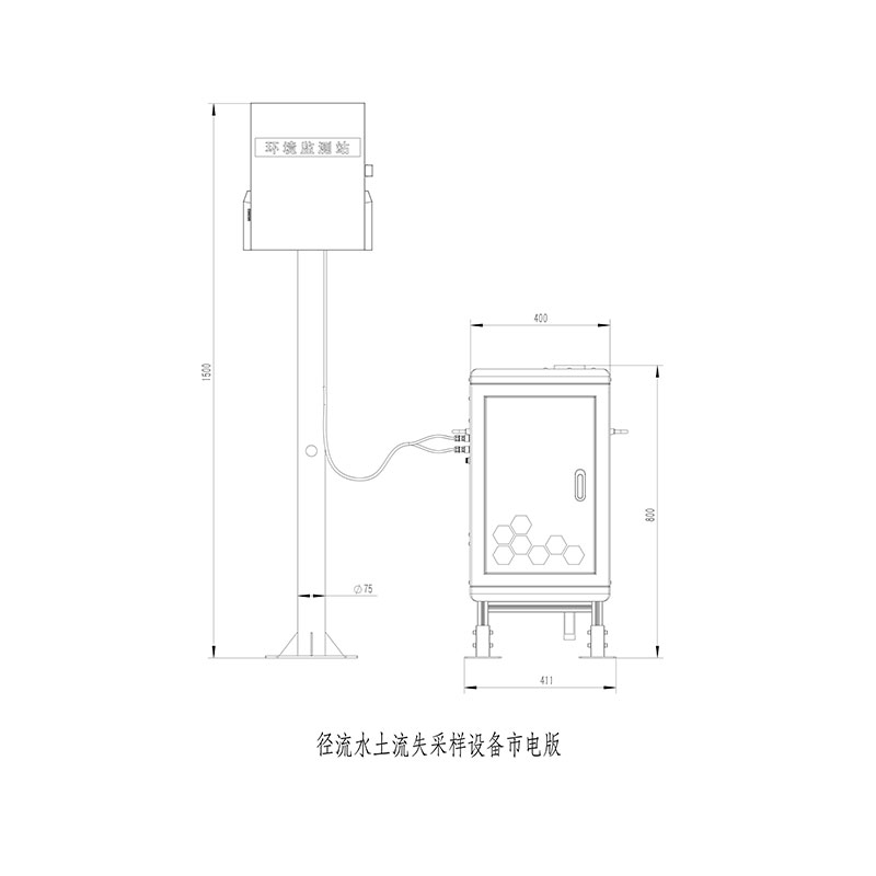
4.Fully Automated Soil Erosion Monitoring System product size and working diagram
5.Fully Automated Soil Erosion Monitoring System Maintenance and Maintenance
Please loosen the transport fixing rod before first use, otherwise the equipment will not work properly.
Please re-use clean water and zero point calibration when you are not required for the first time or if you are not required for a long time.
Check the water storage tank regularly.If there is a lot of sludge deposited or there is debris, please remove it.You can remove the drain valve and rinse it clean.
Regularly check whether the drain valve, sample barrel water inlet valve, sample barrel drain valve, and whether the water flow is unobstructed.If the water flow is weak or not, the control line on the drain valve can be cancelled and the drain valve can be removed for cleaning, and then reinstalled.
Keep the inside of the equipment clean, prohibit the accumulation of items in the weighing part, and prohibit placement of items under the sample barrel.
When the temperature in the area where the equipment is located is as low as below zero, please drain the moisture inside the equipment and place the icing to damage the equipment.
When the sensor has a long service life, it can be calibrated and corrected by matching the instrument.When the sensor is maintained and maintained by the above method, it means that the sensor is damaged.
6.Introduction to Fully Automated Soil Erosion Monitoring System Cloud Platform
The IoT cloud platform is a data reception, processing and analysis platform based on IoT communication technology.It supports MQTT device communication protocol, supports HJ212-2017 and HJ212-2005 environmental protection protocols, supports TCP/IP short-link data forwarding, supports HTTP protocol data forwarding, supports real-time and historical data query and analysis, supports waveform diagram display of time series data, supports data aggregation, supports real-time video access, supports device maps, etc.
Golden needle mushroom is a popular edible mushroom in the market, its good taste and rich in many nutrients, whether it is cooked spicy hot, or cooked hot pot grilled fish, it is a good side dish. What's more, it contains anti-cancer active substances and is a famous mushroom for food and medic...
Wave measuring instrument for wave-making pool is a specialized device for accurately measuring free-flow wave parameters and water level height. It is suitable for long-term reliable monitoring in marine, port, reservoir, and lake environments, providing crucial data support for hydrological research, engineering testing, and safety early warning....
greenhouse sensors Monitor the environmental conditions of the greenhouse and integrate the light sensor, carbon dioxide sensor, air temperature sensor, air temperature and humidity sensor....
Shandong Fengtu Technology is a professional manufacturer of domestic water quality testing instruments, providing handheld COD analyzers and portable multi-parameter water quality analyzers. These analyzers can measure parameters such as water temperature, pH, ammonia nitrogen, dissolved oxyg...


 Get a Free Quote
 Skype
Skype
 whatsapp
 mail
mail