Shandong Fengtu IOT Technology Co., Ltd
Sales Manager:Ms. Emily Wang
Cel,Whatsapp,Wechat:+86 15898932201
Email:info@fengtutec.com
Add:No. 155 Optoelectronic Industry Accelerator, Gaoxin District, Weifang, Shandong, China


Sales Manager:Ms. Emily Wang
Cel,Whatsapp,Wechat:+86 15898932201
Email:info@fengtutec.com
Add:No. 155 Optoelectronic Industry Accelerator, Gaoxin District, Weifang, Shandong, China
time:2026-05-14 09:52:33 source:Weather Station viewed:193 time
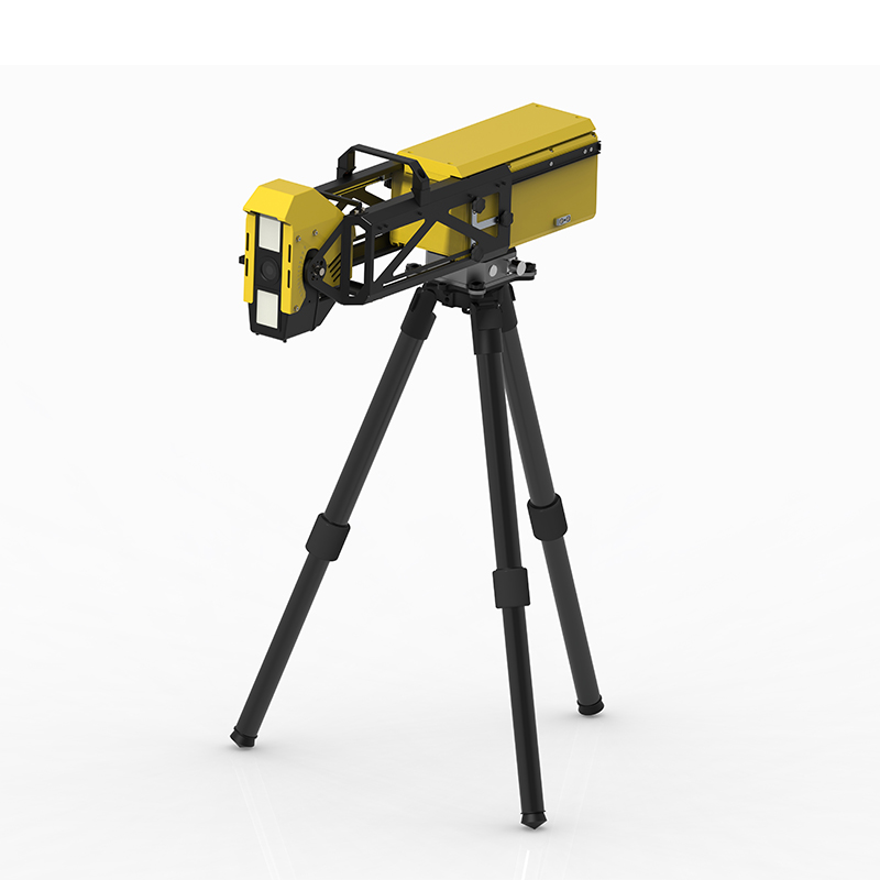
Slope Stability Radar integrates multiple sensors, including slope radar, to achieve 24-hour automated monitoring of geological disasters such as landslides, collapses, and debris flows. The system boasts sub-millimeter deformation measurement accuracy and intelligent early warning capabilities, making it suitable for scenarios such as open-pit mines, highway and railway slopes, and water conservancy projects.
Slope Stability Radar utilizes various technologies to achieve comprehensive real-time monitoring and early warning of geological disasters such as landslides, collapses, and debris flows. The system integrates multi-source sensing equipment, including GNSS high-precision positioning, slope deformation monitoring radar, soil and rock sensors, and video surveillance, enabling automated and continuous acquisition of key parameters such as slope surface displacement, deep internal displacement, groundwater level, rainfall, crack changes, and stress and strain of the support structure. Taking radar technology as an example, current mainstream slope deformation monitoring radars are based on Arc Synthetic Aperture Radar (ArcSAR) and phase differential interferometry technology. They can achieve 360° omnidirectional scanning, sub-millimeter deformation measurement accuracy, and a measurement distance of several kilometers. They are unaffected by cloud cover, rain, fog, or lighting conditions, enabling continuous monitoring around the clock.
At the data acquisition level, the equipment can acquire millimeter-level displacement changes on the slope surface in real time, accurately capturing even extremely subtle surface displacements. It can also detect changes within the slope interior and deep soil and rock masses. Furthermore, due to its non-contact remote sensing characteristics, a single radar system can cover a large mountain area, allowing for rapid deployment at emergency rescue sites and eliminating secondary disasters that threaten the safety of rescue personnel and equipment.
Slope Stability Radar is equipped with an intelligent early warning platform. All monitoring data is transmitted in real time to the backend data management and analysis system via wired, wireless networks, or BeiDou short message services. The platform utilizes big data analytics, intelligent algorithms, and visualization technologies to interpret and analyze massive amounts of monitoring data. It can determine the overall stability of slopes and quickly issue early warnings of landslides, collapses, and other disasters when monitoring data exceeds preset thresholds, buying valuable time for disaster prevention decisions and personnel evacuation. This system is currently widely used in scenarios such as open-pit mine slopes, tailings dams, highway and railway slopes, hydropower station dams, and tunnel entrances, providing reliable technical support for the safe operation of various projects and the early identification of geological hazards.
Greenhouses play a vital role in agricultural production, providing indispensable support for the cultivation of high-value vegetables, anti-seasonal crops and rare fruits, making their position in the modern agricultural field more and more prominent.Greenhouse greenhouse has many advantages, it is...
The season of frequent rainfall is accompanied by a corresponding increase in the risk of urban and rural flooding, flash floods, geological disasters and river flooding. During the rainy season, it is critical to accurately monitor rainfall, safeguard infrastructure, rationally plan agricultural ir...
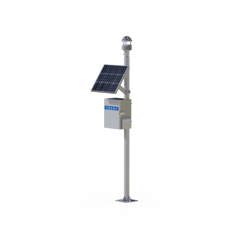
The integrated weather monitoring system, also known as weather station, provides timely warning of possible weather disasters by collecting, processing and analyzing weather elements in real time. It is mainly used in the field of agricultural production, emergency management of cities and industri...
Windway introduces the 10-in-1 Micro Weather Meter, a solution to the challenges of environmental monitoring. This device is capable of comprehensively monitoring key environmental indicators such as temperature, humidity, barometric pressure, wind speed, wind direction, illuminance, rainfall, noise...


 Skype
Skype
 whatsapp
 mail
mail