Shandong Fengtu IOT Technology Co., Ltd
Sales Manager:Ms. Emily Wang
Cel,Whatsapp,Wechat:+86 15898932201
Email:info@fengtutec.com
Add:No. 155 Optoelectronic Industry Accelerator, Gaoxin District, Weifang, Shandong, China


Sales Manager:Ms. Emily Wang
Cel,Whatsapp,Wechat:+86 15898932201
Email:info@fengtutec.com
Add:No. 155 Optoelectronic Industry Accelerator, Gaoxin District, Weifang, Shandong, China
time:2026-03-20 09:47:44 source:Weather Station viewed:275 time
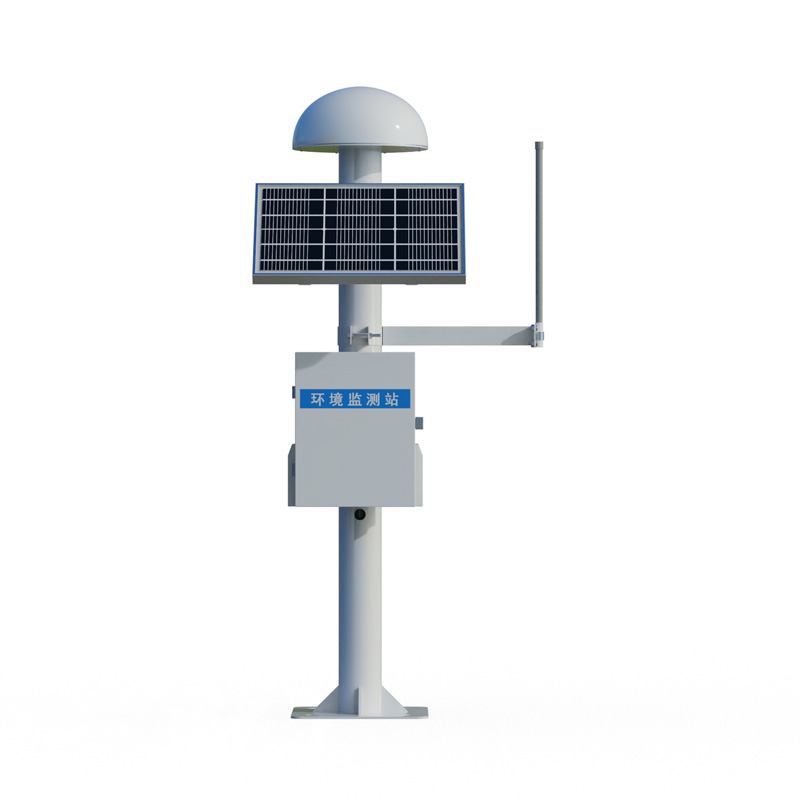
GNSS Monitoring Equipment employs Differential RTK technology, achieving a horizontal accuracy of ±2.5 mm + 1 ppm and a vertical accuracy of ±5 mm + 1 ppm. The device integrates a choke-ring antenna and offline processing capabilities, operating automatically in all weather conditions. It is widely utilized for the real-time monitoring of surface displacement and structural deformation in dams, bridges, slopes, and mining sites.
GNSS Monitoring Equipment is a product based on Global Navigation Satellite Systems (GNSS) designed to achieve millimeter-level displacement monitoring. It utilizes Differential RTK technology to perform real-time calculations of surface displacement and structural deformation. The device operates within a power supply range of DC 10V to 15V with a power consumption of just 0.25 Watts, effectively meeting the low-energy requirements for long-term field deployments. In static differential mode, it achieves a horizontal accuracy of ±2.5 mm + 1 ppm and a vertical accuracy of ±5 mm + 1 ppm, enabling the precise detection of deformation information regarding the monitored object.
Regarding antenna configuration, the device features a choke-ring design combined with magnetic wave-absorbing materials. This effectively suppresses signal interference caused by multipath effects, ensuring data acquisition stability even in complex environments. The communication protocol supports Modbus-RTU; the device itself can perform offline calculations of displacement values and directly output vertical and horizontal deformation data, eliminating the need to rely on a backend platform for secondary processing. Additionally, it is compatible with the RTCM3 differential data format, facilitating seamless integration with reference station networks from various manufacturers.
The device features a compact form factor with a diameter of 360 mm and a height of 163 mm, making it highly suitable for on-site installation. It operates reliably within an ambient temperature range of -40°C to +85°C and a relative humidity range of 0% to 95% (non-condensing), thereby meeting the requirements for continuous observation in harsh climatic conditions—including extreme cold, high temperatures, and high humidity.
In terms of applications, the device is widely deployed across engineering fields such as dam safety monitoring, bridge structural health assessment, and landslide early warning systems. In dam monitoring scenarios, the device provides real-time feedback on the dam body's horizontal displacement and vertical settlement, enabling data updates and early warning responses with millimeter-level precision. Bridge structures undergo deformation due to temperature loads and wind-induced vibrations; through continuous, automated data acquisition, the GNSS Monitoring Equipment system assists engineers in tracking trends in bridge tower displacement and main girder deflection. Regarding geological hazard mitigation—specifically concerning potential landslide sites and mine slopes—the device incorporates offline processing capabilities to minimize the risk of data loss caused by communication interruptions, thereby ensuring that deformation processes are continuously recorded even in areas with poor signal coverage.
Monitoring systems typically employ a deployment configuration consisting of a reference station paired with multiple monitoring stations. The reference station receives satellite signals and generates correction data via differential calculations, while the monitoring stations combine this data with their own observational readings to perform RTK computations, yielding positioning results with centimeter-level—or even millimeter-level—precision. The device features a high degree of integration; on-site installation requires only simple mechanical mounting and electrical connections. When combined with solar power supply and 4G or BeiDou short-message communication capabilities, it enables the establishment of a fully automated, unattended monitoring network.
The device supports the real-time output of displacement data, allowing monitoring personnel to utilize a dedicated platform to visualize cumulative displacement curves and rate-of-change trends for each monitoring point. Should deformation exceed a pre-configured threshold, the system automatically triggers an early warning notification, alerting relevant personnel to take appropriate remedial actions. Currently, this technology has been extensively applied in the monitoring of landslides, open-pit mines, highway slopes, and high-rise building tilt, effectively enhancing early warning capabilities for geological hazards and improving the timeliness of structural safety assessments for infrastructure.
During the crop growing season, crops are on the verge of extinction due to a drop in temperature, known as a low-temperature disaster. When low temperature disaster occurs, it is usually manifested by low temperature, insufficient sunshine and rainy weather. Low temperature disaster and frost disas...
Windway Technology BOD automatic monitor is now available, welcome to consult and order!This is an automatic monitoring instrument of BOD, what is BOD? Its refers to biochemical oxygen demand (biochemical oxygen consumption), there are some aerobic microorganisms in the water body, under certain tem...
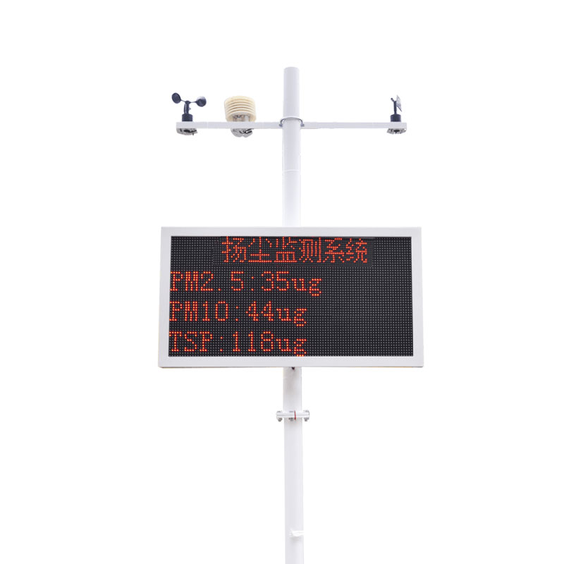
meaning of rain gauge is a device for measuring rainfall, a meteorological instrument for measuring the amount of precipitation per unit area in a given time....
Park air quality monitoring station is an important part of urban garden construction in my country, and its main function is to monitor the concentration and distribution of air pollutants in parks. With the continuous acceleration of urbanization and the rapid growth of urban population, the probl...


 Skype
Skype
 whatsapp
 mail
mail